
3 Days In Sequoia And Kings Canyon: Itinerary & Tips

I recently took my mom on a California National Parks road trip. We started at LAX, drove north to Sequoia, and spent three days exploring together. It turned out to be one of my favorite trips I’ve ever taken.
In this guide I’m sharing our itinerary for Sequoia National Park, plus everything you need for Kings Canyon next door. Whether you have one day or four, I’ve got you covered with specific day-by-day plans, honest thoughts on what to skip, and all the practical logistics to deal with crowds and save time.
In this article:
- How Sequoia and Kings Canyon work together (and why it matters for planning)
- Itinerary for 2 days in Sequoia National Park
- One day in Kings Canyon, including Cedar Grove and Mist Falls
- Seasonal access guide (what’s open and closed by month)
- Where to stay and where to eat
- Tips for parking, shuttles, bears, altitude, and more
Disclaimer: This article features some affiliate links. I only endorse things I’ve personally used or that come highly recommended by trusted peers. If you purchase anything I mention using my referral links from Amazon, REI or other retailers I may receive a small commission. However, there is never extra cost to you. You can read more here. Thank you for your support.
Sequoia National Park Overview
✈️ How To Get There: Fly into Fresno (1.5 hrs) or Los Angeles/San Francisco (4–4.5 hrs)
🌳 Sequoia Must-See: General Sherman Tree, Congress Trail, Moro Rock, Tokopah Falls
⛰️ Kings Canyon Must-See: Mist Falls, General Grant Tree, Zumwalt Meadow, Roaring River Falls
🎟️ Best Excursions: Self-guided driving tour, Crystal Cave tour, guided hiking tour in Sequoia
💵 Entrance Fee: $35 per vehicle (7 days) or free with an America The Beautiful Pass
🛌 Where To Stay: Wuksachi Lodge in Sequoia and John Muir Lodge in Kings Canyon
TIP: I recommend booking your rental car with Discover Cars. They search across the major rental companies to find the best rate and let you cancel for free up to 48 hours before pickup, so you can grab a good rate now without stressing if your plans change.
Understanding Sequoia and Kings Canyon National Parks
Before diving into the itinerary, it’s worth understanding how these two parks actually work because they confuse a lot of first-time visitors, myself included.
Sequoia and Kings Canyon are separate national parks, but they’re managed together as one unit (often abbreviated SEKI). You pay one entrance fee and it covers both parks.
Sequoia’s main entrance is the Ash Mountain Entrance near Three Rivers off Highway 198. Kings Canyon’s main entrance is the Big Stump Entrance off Highway 180 near Fresno.
Once you’re inside either park, Generals Highway connects them.
A few things worth knowing upfront:
- ⏳ The Ash Mountain Entrance (Sequoia) can have extremely long lines. On summer weekends and holidays, you can wait over an hour if you’re entering between 9am and 1pm. Either arrive by 8am or wait until 3pm when things thin out.
- 🚗💨 The Big Stump Entrance to Kings Canyon almost never has a line, regardless of when you arrive.
- 🐢 Generals Highway is slow. It’s paved and drivable in a regular car, but the switchbacks and grades limit your speed. Budget more time than Google Maps suggests for driving between the two parks.
- ⛰️ The parks are at altitude. The Giant Forest and Lodgepole areas sit around 7,000 feet. If you’re coming from sea level, pace yourself, stay hydrated, and don’t be surprised if you feel more tired or winded than usual on the first day.
- 🐶 Dogs aren’t allowed on trails. They’re permitted in campgrounds and paved roads, but not on hiking trails or in buildings. (If you’re traveling with a dog, I have some recommendations for hikes they’re allowed on below!)
- ⛽ There’s no gas inside either park. Fill up before you enter. Stony Creek, along Generals Highway between the two parks, is the closest option once you’re inside.
- 📱 Cell service is essentially nonexistent. Download your maps on Google Maps and AllTrails before you lose signal.
TIP: You can save 30% on your AllTrails+ membership with discount code EVERYWHERE30. Click here to get a year for $25!
How To Get To Sequoia National Park
The best way to get to Sequoia is to fly into Fresno (FAT) and rent a car. It’s only 1.5 hours from the Ash Mountain Entrance.
San Francisco (SFO) and Los Angeles (LAX) both have more flight options and often better prices, but add 3–4.5 hours of driving depending on traffic.
TIP: If you put Foothills Visitor Center into your GPS it’ll route you to the correct Ash Mountain Entrance through Three Rivers along Highway 198. (Not to Mineral King, which is an annexed part of the park)
Airports Near Sequoia National Park
- Fresno (FAT): 1.5 hours
- Los Angeles (LAX): 4+ hours (traffic dependent)
- San Francisco (SFO): 4.5 hours
Map Of Sequoia National Park
Sequoia has five main areas:
- Foothills — lowest elevation, mild weather, open year-round, near Ash Mountain Entrance
- Giant Forest — where you’ll find General Sherman, Moro Rock, and the Congress Trail
- Lodgepole — campground, visitor center, Tokopah Falls trailhead, Lodgepole Grill
- Wuksachi — where the lodge is located
- Mineral King — remote southern section, separate entrance, not covered in this itinerary
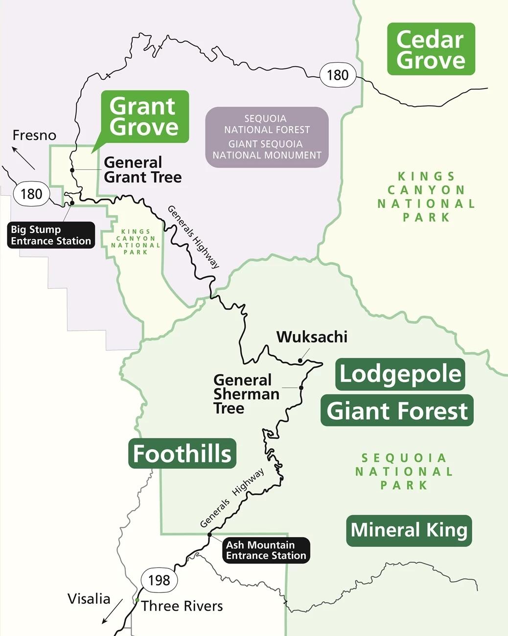
The main road through the park is Generals Highway, which runs from the Ash Mountain Entrance through Foothills, Giant Forest, Lodgepole, and Wuksachi before crossing into Kings Canyon.
Use this map to plan your Sequoia National Park itinerary! I’ve labeled items by activity type (noted by icon).
How To Use This Map:
1. To open in a new tab, click [] in the top right corner of the map.
2. To save to your Google Maps account, click ☆ (you must be signed in to Google).
3. To use during your trip, open Google Maps on your phone, select “You” from the bottom bar, scroll down and click the maps icon for a list of your saved custom maps.
Day 1: Sequoia National Park Itinerary
My mom and I started our trip in Los Angeles. She flew in and I picked her up in my campervan, then we drove about four hours north to arrive in Sequoia by early afternoon. During our first afternoon, we were able to cover everything from the entrance up to General Sherman, and it was the perfect amount for day one.
1. Foothills Visitor Center

Your first stop should be the Foothills Visitor Center, right inside the Ash Mountain Entrance. I know it’s tempting to blow past it and head straight to the big trees, but I always like to pop into the visitor center and speak with the ranger on duty.
Rangers are a great resource for current trail conditions, flagging any bear activity or closures, and can tailor itinerary recommendations to exactly what you want to do and how long you have.
TIP: Speaking with a ranger is also how I get great recommendations for nearby dog-friendly trails where I can walk my dog, too! They know all the best spots and are familiar with local regulations.
The visitor center is also where you can get your National Parks Passport stamped if you collect those (I’ve had mine since I was a kid and never miss a chance to stamp it!)
2. Tunnel Rock

Just past Foothills, pull off for a quick stop at Tunnel Rock. This granite formation used to be part of Generals Highway and cars would drive right underneath it.
However, modern vehicles are too large so the road had to be rerouted around it. It’s a two-minute stop but a good one to stretch your legs and get a cool photo.
3. Amphitheater Point Viewpoint

As you continue up the mountain on Generals Highway, Amphitheater Point is a quick pull-off with panoramic Sierra views.
It’s not uncommon to spot wildlife from here, especially during dawn and dusk. We saw a fox on our drive up!
TIP: Download this self-guided driving tour before your trip! It’s just like having a tour guide to point out landmarks, interesting history, geological explanations, etc — except for a fraction of the cost (less than $20), on your own schedule and without any crowds.
Once you download it to your phone, the guide uses your GPS signal to automatically play whenever you’re near a landmark, so it still works even without cell service.
4. General Sherman Tree + Congress Trail
Distance: 1.2 miles (Sherman Tree only) or 2.9 miles (full Congress Trail)
Elevation Change: 485 ft
Rating: Easy
Time Needed: 1-2 hours
Location: Giant Forest Area
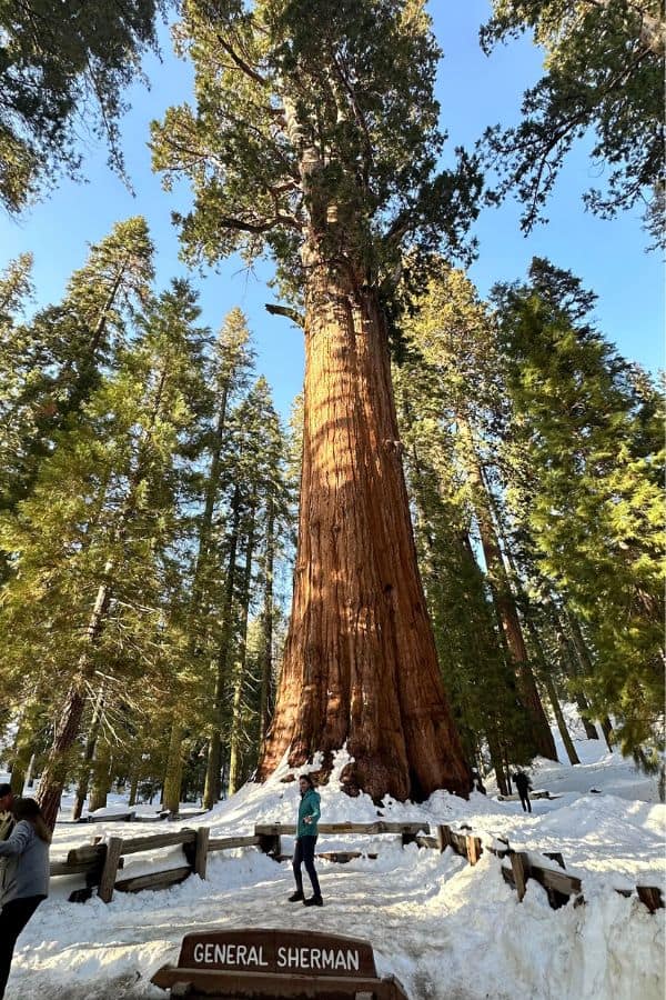
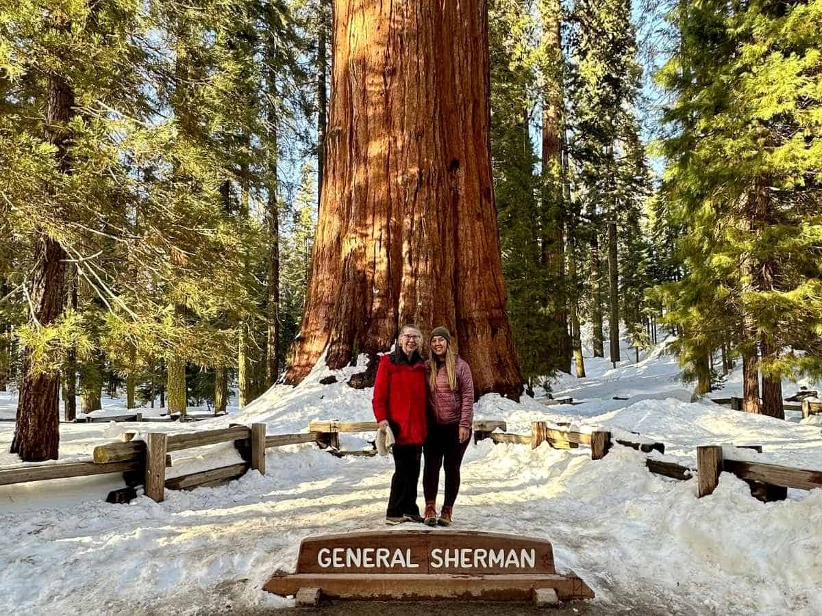
The General Sherman Tree is the largest living tree on Earth by volume (275 feet tall, 2.7 million pounds), somewhere between 2,200 and 2,700 years old.
If you’re short on time, you can hike out-and-back to General Sherman. It’s 1.2 miles total, and takes about half an hour (although there can be a big crowd near the tree, so budget some additional time if you want a photo).
Otherwise, I recommend walking the full Congress Trail. This 2.9-mile loop takes you past some of the most impressive named trees in the grove: McKinley Tree, The President, The House and Senate groups, The Room Tree (a short 1-minute detour south past McKinley Tree to a still-living sequoia with a fire-hollowed interior big enough to walk inside), and the Chief Sequoyah Tree.
NOTE: This trail is completely paved, but some steeper sections may make it challenging for strollers or wheelchairs.
Since most visitors come to see General Sherman then leave, the rest of Congress Trail is much quieter than the first half mile.
There are two parking lots for General Sherman. The first lot is right off General Highway and is very small. It’s designated for handicap use only during the summer. In the winter, it’s accessible to all visitors (but remained completely full during my visit in early March).
The second parking lot is much larger, and is located off of Wolverton Road. It sits at the top of the hill, so be prepared to hike down and back up a fairly steep incline (over 200 feet in less than half a mile – there are lots of benches along the trail to rest).
TIP: The General Sherman parking lot typically fills by 9am during the summer. Instead, I recommend you park at Giant Forest Museum and take the free park shuttles for the afternoon. It will save you so much time.
From the Giant Forest Museum, take the green shuttle one stop to General Sherman Tree Trailhead (which is at the bottom of the hill, so you can skip the steep hike up to the parking lot!) If Giant Forest Museum parking is full, park at Lodgepole Campground which is also on the green shuttle route.
5. Tunnel Log

After, backtrack slightly towards Tunnel Log, along Crescent Meadow Road. You’ll need to take the green shuttle (route 1) back to Giant Forest Museum and transfer to the gray shuttle (route 2).
It sounds counterintuitive to backtrack, but this Sequoia itinerary will actually save you time.
General Sherman Tree gets very busy later in the day, so it’s best to see it first. Plus, during the summer Crescent Meadow Road is only accessible by shuttle until mid-day on weekends and holidays.
By visiting Crescent Meadow later in the day, you’ll avoid crowds and may be able to drive your own vehicle if the road has reopened.
On the way to Crescent Meadow, you’ll pass through Tunnel Log, a fallen sequoia with a tunnel carved through it wide enough to drive a car through (as long as it’s under 8 feet tall).
The tree died naturally and fell across the road in 1937; the following year the tunnel was carved to keep traffic moving. It’s a fun stop and a good photo op.
NOTE: Crescent Meadow Road is only open in the summer (roughly late May through November). In the winter, you can walk or ski along the road to get to the meadows and Tunnel Log – it’s 1.8 miles each way.
6. Crescent Meadow & Tharps Log

Distance: 1.3 miles
Elevation Change: 131 ft
Rating: Easy
Time Needed: 30-45 minutes
Location: Giant Forest Area
John Muir called Crescent Meadow the “gem of the Sierras,” and it’s easy to see why. The meadow is a great picnic spot, and the loop trail passes through old-growth sequoias with some beautiful views along the way. It’s also typically much less crowded than other areas in the park.
NOTE: Wildlife is common in this area, including bears which are drawn to the Huckleberries.
From Crescent Meadow, there’s an easy trail (<1 mile one-way) to Tharps Log. It’s a cabin built inside a fallen sequoia tree in 1861 and it’s still intact over 160 years later.
As an out-and-back, the trail to Tharps Log is 1.7 miles. However, I think it’s best if you combine it with the Crescent Meadow Loop so you can cover more ground without doubling back. The loop, including a short detour to Tharps Log, is 1.9 miles total and also passes Chimney Tree and Cleveland Tree.
Tharps Log is named after Hale D. Tharp, who is believed to be the first Non-Native American to inhabit the Giant Forest (from 1861 – 1890). He spent the summers in this hollowed out tree while grazing his cattle in the area.
In 1875, the cabin was visited by John Muir (who later named the area “The Giant Forest”).
7. Moro Rock

Distance: 0.5 miles
Elevation Change: 183 ft
Rating: Moderate
Time Needed: 30-45 minutes
Location: Giant Forest Area
Moro Rock is a granite dome in the Giant Forest area, next to Crescent Meadow, with one of the best viewpoints in the park.
You can take the park shuttle here from Crescent Meadow (gray line, route 2) or hike Sugar Pine Trail, which connects Crescent Meadow trailhead to Moro Rock trailhead. It’s about 1.5 miles and mostly downhill.
It’s only a quarter mile to the top of Moro Rock, but there are over 350 steps and it’s steep. At the summit you get two completely different views: the Central Valley spread out to the west, and the Great Western Divide rising dramatically to the east.
If you can time this for sunset, it’s exceptional! To the east, the mountains glow pink in the alpenglow while the foothills to the west turn orange.
By this point you’re deep in the park. I recommend you stay at Wuksachi Lodge for the night if you can get reservations (they book out at least 6 months in advance). It’s the only lodge inside Sequoia and is well-positioned for day 2.
Otherwise, Lodgepole and Dorst Creek campgrounds are both nearby or you’ll have to backtrack about an hour one-way to Three Rivers (I’ve included more hotel recommendations below!)
Day 2: Sequoia National Park Itinerary
I recommend getting out early before the main trailheads fill up.
1. Crystal Cave
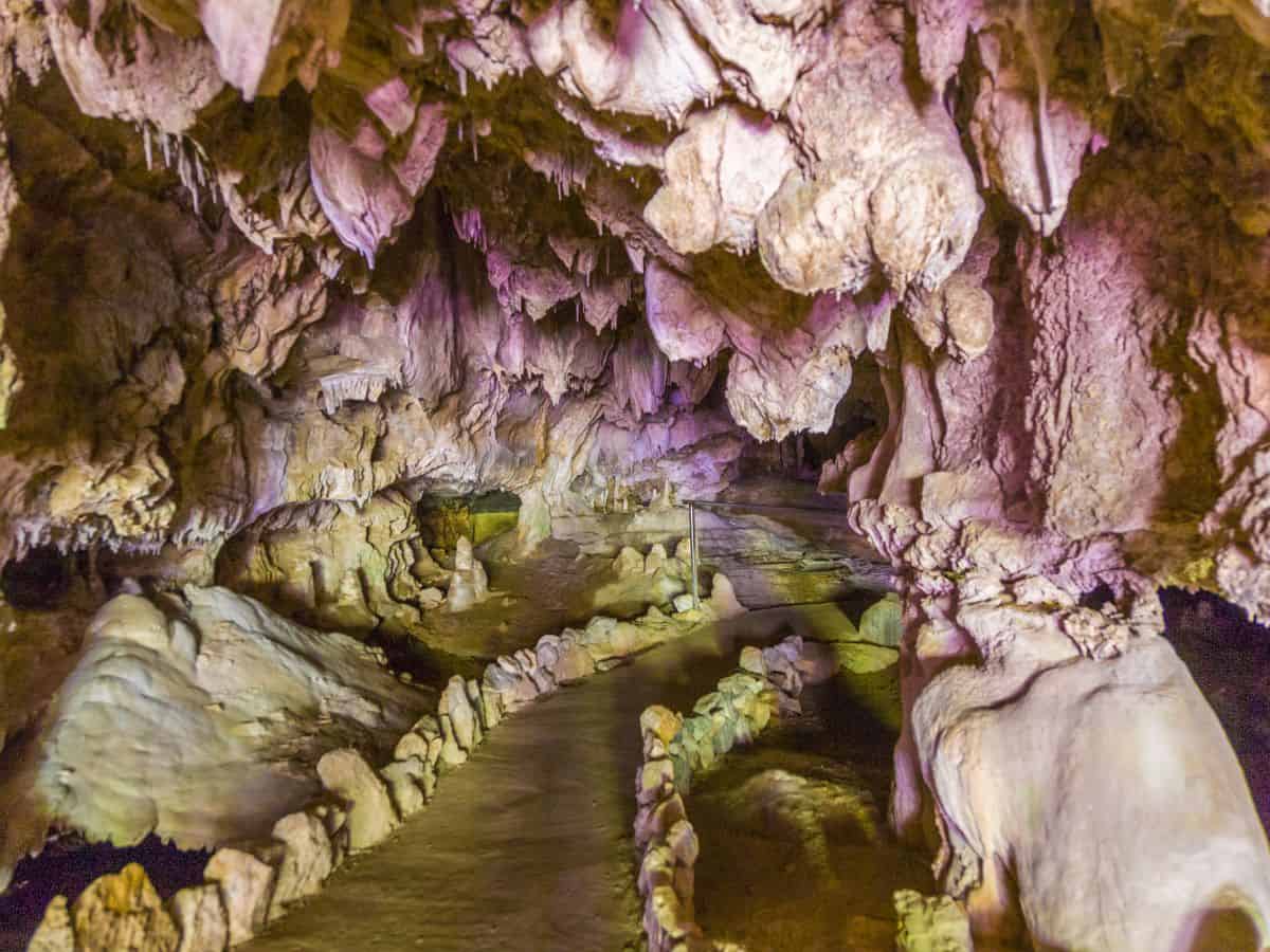
Crystal Cave is a marble cavern in the Sequoia foothills and one of the more unique things you can do in the park. After being closed for several years, it recently reopened in 2025.
Tours are guided and last about 50 minutes. Plan to walk about half a mile while on the tour, with several slippery or steep sections and plenty of stairs. The caves are open annually from late May through November 1.
Tickets must be purchased online in advance ($24/adult). They generally go on sale in early April. No tickets are sold at the cave entrance.
Most days, tours are available beginning at 9am, and offered at the top of every hour until 3 pm. During busy times (like July and August) tours are also available beginning on the bottom of the hour.
TIP: Pack a snack, there aren’t many options in this area of the park. You’ll also want a light jacket as the caves are 50°F year-round.
Travel logistics: There is no shuttle access to Crystal Cave so you must drive yourself. The cave is about an hour and a half drive from the Sequoia entrance (which can also have up to a one hour entrance wait), and about 45-minutes from the Giant Forest Museum. Vehicles longer than 22 feet are not permitted on the road to the caves.
2. Giant Forest Museum

After your cave tour, drive to Giant Forest Museum and park your vehicle for the rest of the day. It’s much easier to take the shuttles around once the parks get more crowded by late morning.
Giant Forest Museum is a genuinely good museum! It’s not just a gift shop with a few boring display panels. There are interactive displays for both kids and adults, including a spinning “fate of a sequoia pinecone” wheel and a display comparing sequoia size to a football field.
The museum is fairly small, so it doesn’t take much time to walk through, and it provides a lot of context around the lifecycle of a Sequoia tree that’ll make you appreciate their evolution and survival even more. It’s a good (and free) 30-minute stop while you’re in the area.
3. Big Trees Trail

Distance: 1.2 miles
Elevation Change: 104 ft
Rating: Easy
Time Needed: 30-45 minutes
Location: Giant Forest Area
From the Giant Forest Museum, it’s less than half a mile walk to Big Trees Trailhead. You can follow the Alta Trail (starts behind Sentinel Tree in the parking lot of Giant Forest Museum) which runs parallel to the road before crossing the street to the Big Trees loop.
I would highly recommend walking. The parking situation at Big Trees Trailhead is… rough. Even during the low season we had a hard time getting a parking spot. Walking will actually be a faster and less frustrating option.
Big Trees Trail is a mostly flat, paved, fully accessible loop through a sequoia grove around a meadow. It has interpretive signs throughout, and it’s legitimately beautiful!
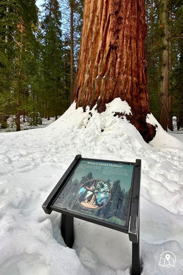
When I hiked it with my mom in March, the grove had several feet of snow which nearly covered the signs. It’s crazy to me that the trees are so massive, they still look enormous when the bottom 5 feet of their trunk is buried in snow.
When it’s not covered in snow, there’s a nice boardwalk that loops the meadow and weaves through the giant sequoia trees. It’s very accessible and stroller-friendly.
4. Lodgepole Village
Next, hop on the green shuttle and head to Lodgepole Village for lunch. The Lodgepole Grill serves burgers, wraps, and salads from a kiosk. There’s also a market with grab-and-go options, flush toilets, coin laundry, showers, and wifi.
If you’re ravenous, eat lunch in the area. But if you can hold out a little while longer I think lunch tastes much better if eaten next to a waterfall! Which is what’s up next…
5. Tokopah Falls

Distance: 4.1 miles
Elevation Change: 626 ft
Rating: Moderate
Time Needed: 2-3 hours
Location: Lodgepole Area
Across the parking lot from Lodgepole Visitor Center is the trailhead to Tokopah Falls. If you follow the river you can’t miss it.
Tokopah Falls is one of the better hikes in the park and one of the most crowd-free relative to its quality. The trail follows the Marble Fork of the Kaweah River through a dramatic glacially carved valley and ends at a 1,200-foot waterfall dropping over a granite wall.
The trail is mostly shaded until the last half mile or so, which makes it more manageable on hot summer days. It’s consistently uphill the entire way, so hiking poles are a good idea (especially for the downhill return).
Pay particular attention near the rocky sections along this trail! Pikas and marmots are very common, and occasionally there are rattlesnakes along the path.
TIP: The falls are most impressive May through early July when snowmelt is running strong. By late August, they can be significantly reduced or barely flowing. Still a beautiful hike, but ask a ranger about current conditions and set expectations accordingly.
6. Little Baldy Trail (Sunset)
Distance: 3.3 miles
Elevation Change: 800 ft
Rating: Moderate
Time Needed: 2-3 hours
Location: Wuksachi Area
Little Baldy is a 3.3-mile trail up the road from Wuksachi Lodge, just past Halstead Meadow with 360-degree summit views and good wildlife sightings along the way.
It’s a nice hike any time of day, but I would especially recommend it for late afternoon or sunset. The summit looks west over the Central Valley and east toward the Sierras, very similar vibe to Moro Rock but without the crowds and the stairs (although there’s still decent elevation gain).
TIP: Bring a headlamp and layers; it can cool down quickly once the sun drops.

Have dinner and spend the night at Wuksachi Lodge, or head back to Lodgepole (everything else is at least an hour drive south, and tomorrow we’re heading north into Kings Canyon!)
Wuksachi’s Peaks Restaurant requires reservations for dinner and runs $30–50 per person. It’s a fancier sit-down restaurant and has surprisingly good food for a National Park.
The Pizza Deck is the more casual option (but closes at 5pm), or head to Lodgepole Grill for “fast-casual” (open until 9pm and offers grab-and-go from the market). Check current hours at visitsequoia.com before you go, as they vary by season.
Day 3: Kings Canyon Itinerary
Kings Canyon is a completely different park than Sequoia, but they’re right next to each other, connected by Generals Highway, and it’s absolutely worth seeing both.
There are two separate areas in Kings Canyon; Grant Grove (closest to Sequoia) and Cedar Grove (accessible by a seasonal road).
From the Lodgepole area in Sequoia, it takes approximately 1 hour to drive to Grant Grove via Generals Highway.
TIP: Stop for gas at Stony Creek Lodge. It’s the only option along this route.
1. Drive Generals Highway Into Kings Canyon
I recommend another early start to the day so you can arrive in Grant Grove by early morning before the crowds. Parking can become challenging here by 9am, as it’s the most popular part of Kings Canyon. The best way to save time is to see it early, then head on to Cedar Grove to avoid the worst of the crowds.
On your drive from Sequoia, stop at Redwood Mountain Overlook and Kings Canyon Overlook along Generals Highway for some of the best panoramic views in the park system.
2. General Grant Tree
Distance: 0.7 miles
Elevation Change: 30 ft
Rating: Easy
Time Needed: 20-40 minutes
Location: Grant Grove
Once you reach Grant Grove Village, I suggest heading straight to the General Grant Tree first. This area gets busy by mid-morning, so go early or skip it for the end of the day.
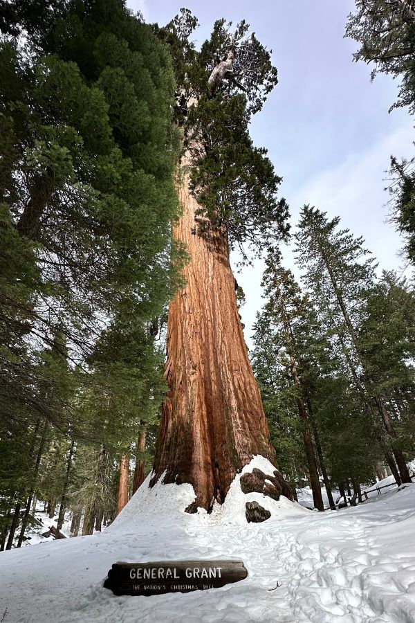
The General Grant Tree is the second-largest sequoia in the world and the only living National Shrine in the United States. The 0.7-mile paved loop takes you to the tree and past the Fallen Monarch (a downed sequoia you can walk through) and the Centennial Stump.
After, backtrack slightly (1 mile) to the village. The Grant Grove Visitor Center has excellent context on what almost happened to this land prior to conservation efforts, including the proposed trans-Sierra highway and multiple dam projects that were defeated.
This is also a good opportunity to speak with a ranger, use the restrooms and WiFi, and grab a picnic lunch from Grant Grove Market for later in the day.
3. Kings Canyon Scenic Byway
After Grant Grove, head east on Kings Canyon Scenic Byway to Cedar Grove. The road descends dramatically from the forested plateau into the canyon floor.
The Cedar Grove section sits at the bottom of one of the deepest canyons in the United States, with walls rising thousands of feet on either side and the Kings River running through it.
While Google Maps shows the drive time from Grant Grove to Cedar Grove is just under an hour, I recommend you plan for 1.5 hours due to the windy road and slow moving traffic.
This road is only open seasonally — typically late May through late September, depending on the year. Check current conditions before your trip.
4. Mist Falls via Paradise Valley Trail

Distance: 8 miles
Elevation Change: 900 ft
Rating: Moderate
Time Needed: 4-5 hours
Location: Cedar Grove
Mist Falls is one of the best hikes you can do in Kings Canyon. It has it all, including wildflowers, wildlife (bears, snakes, tons of butterflies!), meadows, dense forest, mountain views and multiple waterfalls.
Don’t let the distance put you off, though. It’s a relatively easy hike for the first 3 miles without much elevation gain.
The trail starts from Road’s End (literally where the road ends, lol – you can’t miss it!) and is mostly flat for the first 3 miles, following the Kings River through the valley.
The last mile climbs more steeply to the falls, where the Kings River drops 45 feet over a granite ledge into a pool below.
During peak snowmelt (May through July) the force of the water creates a perpetual mist (hence the name). Later in the summer, the flow dissipates but it’s still a worthy hike!
There are lots of good places to rest and have lunch near the waterfall. If you’re brave, you can even go for a dip in the river (but the water is quite chilly!) – I recommend bringing a lightweight towel for this. I’ve reviewed all of my favorite towels for hiking and backpacking here.
TIP: This trail can get quite buggy in the summer. Pack mosquito repellent and a head net!
5. Muir Rock and Swimming

Muir Rock is another great spot to see in Cedar Grove, and it’s a short 0.1-mile trail from the same parking lot at Road’s End. This is a popular spot for a snack break, or a dip in the water.
The Kings River runs cold even in midsummer and conditions can vary, so always use good judgment getting in.
6. Zumwalt Meadow

Distance: 1.5 miles
Elevation Change: 150 ft
Rating: Easy
Time Needed: 30-45 minutes
Location: Cedar Grove
Zumwalt Meadow and Roaring River Falls are both a short drive back along Kings Canyon Scenic Byway. If the park is still busy, I recommend walking from Road’s End to Zumwalt Meadow (just under a mile one-way) instead of battling for parking in the small lot. You can take the trail system instead of the road (River Trail to Zumwalt Meadow/Roads End Trail).
The loop trail around Zumwalt Meadow follows the Kings River, crosses a suspension bridge, and passes below the North Dome. It’s 1.5 miles from the Zumwalt Meadow parking lot, or 2 miles total from Road’s End.
7. Roaring River Falls

Distance: 0.3 miles
Elevation Change: 25 ft
Rating: Easy
Time Needed: 15 minutes
Location: Cedar Grove
Before beginning the drive back to Grant Grove, stop by Roaring River Falls. This is a very easy paved and flat 0.3 mile trail to a gorgeous 40-foot waterfall. It’s the best bang for your buck you can find in Cedar Grove.
This is also a very popular spot, but by late afternoon the crowds taper off (which is why I recommend saving it for last!)
8. Optional Stops On The Way Back To Grant Grove

After spending the afternoon in Cedar Grove, head back towards Grant Grove along Kings Canyon Scenic Byway.
There are a few stops along the way that are nice to break up the drive if you still have daylight.
NOTE: Kings Canyon Scenic Byway cuts through Sequoia National Forest – it’s not technically part of the National Park, so these stops are usually less crowded!
- Grizzly Falls – just outside of Cedar Grove, a 0.1 mile hike to a waterfall with picnic tables and a pit toilet.
- Hume Lake – a small village on the lake with gas and groceries, there’s an easy 3-mile loop around the lake (dog-friendly!) past a sandy beach and mostly shaded.

If you’re visiting Sequoia and Kings Canyon in the spring and early summer, Grizzly Falls is definitely worth a 20-minute stop.
Hume Lake is a pleasant hike, but one I would skip if you’re short on time. However, if you’re traveling with a dog it’s a great place to walk them (my dog, Oscar, really enjoyed this trail!)
9. Big Stump Trail

Distance: 1.7 miles
Elevation Change: 200 ft
Rating: Easy
Time Needed: 45-60 minutes
Location: Grant Grove
The Big Stump Trail is a short loop I think everyone should hike. This meadow was the site of active logging in the 1880s, and the trail winds through the stumps of giant sequoias that were cut down, including the Mark Twain Stump, where you can walk up stairs to stand on top of what remains.
The whole trail reads like a memorial to a forest that almost wasn’t saved, and an important reminder about the importance of ongoing conservation efforts that preserve our National Parks.
It’s a great addition if you have some time (and daylight) remaining on your second day in Kings Canyon National Park.
What I’d skip on a first visit: Hume Lake. It’s not a bad walk, I did it with my mom and dog and we all enjoyed it, but there are better uses of your limited Kings Canyon hours on a first trip. The overall payoff doesn’t compete with Mist Falls or Zumwalt Meadow. I’d save it for a return visit.
Where to eat: Kings Canyon has two main options: the Cedar Grove Grill near Road’s End and the Grant Grove Restaurant. Both serve standard National Park fare — burgers, sandwiches, hot dogs. Check current hours here before you plan meals around them.
Alternate 2-Day Sequoia and Kings Canyon Itinerary
With two days total across both parks, I’d spend one full day in Sequoia covering the highlights, then a full day in Kings Canyon covering Cedar Grove and Mist Falls.
What To Know About The Sequoia Shuttle
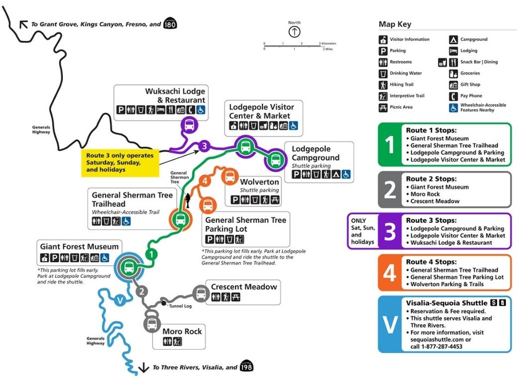
The free Sequoia Shuttle runs late May through early September and is worth using. Parking at the main trailheads fills fast (often by 9am) in summer and the shuttle eliminates the most frustrating part of a busy visit.
Route 1 is the main route and covers most of the popular Giant Forest area.
Route 2 branches off from Giant Forest to Crescent Meadow, Tunnel Log, and Moro Rock.
Route 3 connects lodging and campgrounds to the main areas (weekends and holidays only).
Route 4 connects the General Sherman Tree area with Wolverton.
The shuttle does not go past Wuksachi Lodge, so reaching Little Baldy, Generals Highway north to Kings Canyon, or any trailhead above Lodgepole requires a private vehicle.
There is no shuttle service in Kings Canyon at any time of year.
If you’re coming from Visalia without a car, the Visalia-Sequoia Shuttle ($15 round-trip, reservations required) runs late May through early September from Visalia into Giant Forest, where you can transfer to the Sequoia shuttle routes. It does not run in winter.
Where To Stay In Sequoia & Kings Canyon National Park
Inside Sequoia
Wuksachi Lodge is the best in-park option and the only lodge inside Sequoia National Park.
It’s conveniently located near the Kings Canyon border, and a short drive from Lodgepole and the main Giant Forest trailheads. Rooms start around $300/night in summer and sell out months in advance.
There are also several campgrounds: Lodgepole and Dorst Creek are the most convenient for this itinerary.
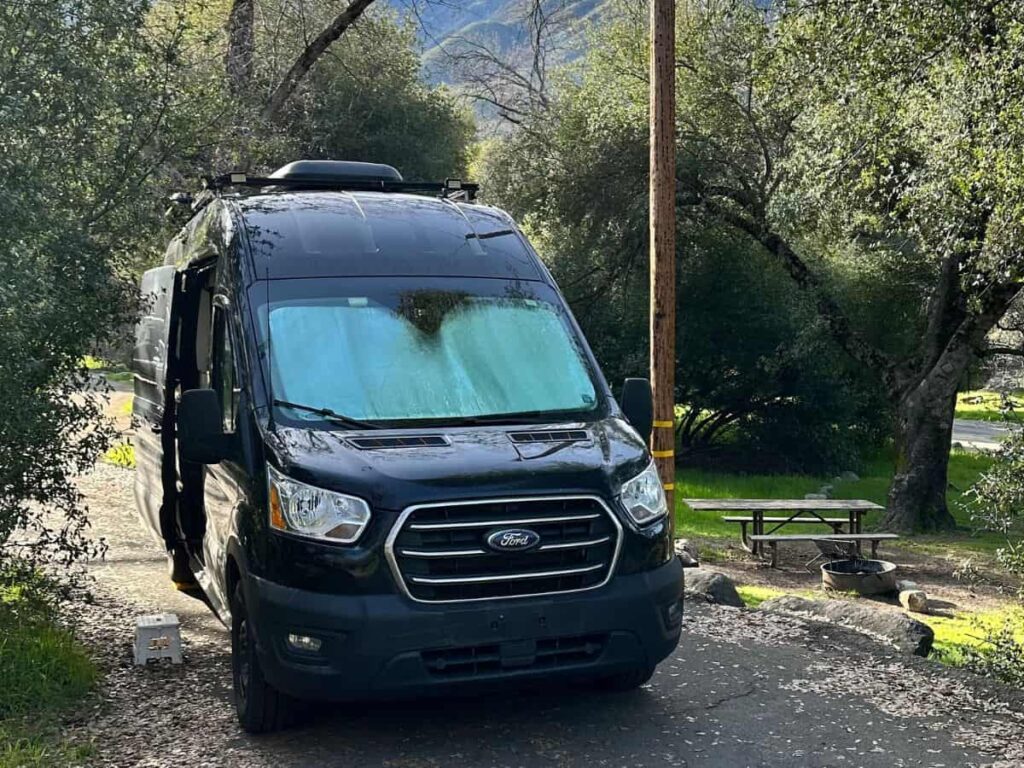
In cooler months, Potwisha Campground is ideal as it’s located at lower elevation (where it’s warmer) near the foothills. We stayed at Potwisha in March and temperatures at night were chilly, but not uncomfortable.
Three Rivers (near Ash Mountain Entrance to Sequoia)
Three Rivers is a small mountain town about 15 minutes from the south entrance for Sequoia and about 45 minutes from the Giant Forest. It’s a good option if you’re arriving in the evening and heading in early the next morning.
- AutoCamp Sequoia — Airstream glamping, unique experience
- Comfort Inn & Suites — mid-range
- The River Inn — budget
- Soleil Luna — 2-bedroom vacation rental
Visalia
Visalia has more options, is a bigger city, but is about 45 minutes from the park entrance. Plan for a 1.5 to 2 hour drive from Visalia into the Giant Forest area of the park.
Personally, I think Visalia requires too much driving to be a good base camp for this trip. However, it’s a good option for saving some money on your day into or out of the park.
- Wyndham — pet-friendly, budget
- The Darling — luxury boutique
Inside Kings Canyon
John Muir Lodge and Grant Grove Cabins in Grant Grove are the best base for exploring both groves in Kings Canyon. It’s under an hour drive on Generals Highway between Grant Grove and the Lodgepole area of Sequoia, and it’s a good home base for Day 1 (Cedar Grove/Mist Falls) and Day 2 (Grant Grove/Big Stump) of your Kings Canyon visit.
Montecito Sequoia Lodge sits along Generals Highway between the two parks and is worth checking if Wuksachi and John Muir are sold out.
Cedar Grove Lodge is available when Cedar Grove Village is open (late May–late September) and offers a more remote, rustic experience.
Campgrounds in Grant Grove: Azalea, Sunset, and Crystal Springs. We stayed at Azalea Campgrounds and thought it was convenient to several trailheads.
Fresno
Fresno is about an hour and a half from Grant Grove. It’s not an ideal base camp, but it’s a good option for your first or final day, especially if you’re flying in and out of FAT airport.
- Fairfield Inn & Suites — mid-range
- Hampton Inn & Suites — pet-friendly
- Garden Inn & Suites — budget
Tips For Planning A Trip To Sequoia National Park
How Many Days Should You Spend?
- 1 day in Sequoia — Good for seeing the essential highlights: General Sherman, Moro Rock, Crescent Meadow, and Big Trees Trail. Also ideal for a winter visit when access is limited.
- 2 days in Sequoia — Adds Crystal Cave, Tokopah Falls, or a longer day hike. Two days is my recommendation for most first-time visitors.
- 3 days in Sequoia — Lets you slow down, do the Giant Forest thru-hike, and explore more remote areas like Little Baldy or Watchtower.
- 1 day in Kings Canyon — Enough to cover Grant Grove, Mist Falls, Zumwalt Meadow, and Cedar Grove.
- 2 days in Kings Canyon — Good for a slower pace, especially during the summer when you have full access to trails and rivers in Cedar Grove.
If you’re adding Yosemite, it’s about 4 hours from Sequoia’s foothills or the Grant Grove area of Kings Canyon — see how I compare Yosemite vs Sequoia for help deciding which to prioritize.
Entrance Fee
The entrance fee is $35 per vehicle, valid for 7 days and good for both Sequoia and Kings Canyon.
If you’re visiting more than two National Parks in a year, an America The Beautiful Pass at $80 covers 2,000+ federal recreation areas for a full 12 months and typically pays for itself quickly.

Reservations
Book Wuksachi Lodge up to a year in advance. Rooms are very limited and sell out months ahead in summer.
Campgrounds can be reserved up to four months in advance at recreation.gov.
Crystal Cave tickets go on sale in April and can sell out fast in July and August.
Bears and Food Storage
Don’t leave food, wrappers, trash, or scented items in your car overnight, ever. Bears in SEKI regularly break through car door frames.
Use the provided bear boxes at trailheads and campgrounds. For day hikes, place scented items in your trunk if no bear boxes are available.
Altitude
The Giant Forest and Lodgepole areas sit at roughly 7,000 feet. If you’re coming from low elevation, you’ll likely notice it.
The thinner air can lead to fatigue on hikes, possible headache, and increased thirst. Drink more water than you think you need and don’t plan your hardest hike on the first day.
Visiting Sequoia National Park by Season
Spring (March–May)
Spring in Sequoia is one of my favorite times to visit! There are significantly fewer crowds, the trails are quiet, and the snow-covered Giant Forest feels so peaceful (especially compared to summer). My mom and I visited in March and loved it, but it requires some planning around seasonal closures.
Weather: Cool and variable. Expect snow at higher elevations into April, with active storms possible through May. Tire chains may be required on Generals Highway during storms. Be sure to confirm with your rental car company whether chains are permitted and/or provided.
Best things to do: Big Trees Trail, General Sherman Tree, and the rest of the Giant Forest area trails. In Kings Canyon, Grant Grove and the Scenic Byway as far as Hume Lake are open.
Closures and callouts:
- Closed in Sequoia: Crescent Meadow Road, Moro Rock Road, Crystal Cave Road, Mineral King Road, and Generals Highway past Giant Forest (no access to Lodgepole or Wuksachi Lodge)
- Closed in Kings Canyon: Panoramic Point Road, Highway 180 to Cedar Grove past Hume Lake, and all Cedar Grove trails and facilities
- The free Sequoia Shuttle doesn’t start until late May
- Moro Rock and Tunnel Log aren’t reachable by car, but you can park at Giant Forest Museum and hike ~1.5 miles one-way to the Moro Rock trailhead if conditions allow
TIP: Check current road conditions before your trip. In a high-snow year, opening dates for seasonal roads can slip well into June.
Summer (June–September)
Summer is peak season for good reason and everything is open, the free shuttle is running (in Sequoia only), wildflowers peak in June and July in the meadows around Crescent and Log Meadow, and Tokopah Falls runs strong through early July.
Weather: Warm at lower elevations, mild and comfortable in the Giant Forest (6,500–7,000 ft). Afternoon thunderstorms are possible in July and August.
Best things to do: Everything is accessible — Moro Rock, Crescent Meadow, Crystal Cave (mid-June through late October), and all of Kings Canyon including Cedar Grove (open late May–late September).
Closures and callouts:
- No closures! This is the one season with full access to both parks
- Ash Mountain Entrance (Sequoia) can back up over an hour between 9am–1pm on summer weekends; Big Stump Entrance (Kings Canyon) rarely has a line
- Giant Forest and General Sherman trailheads fill by mid-morning — use the free Sequoia Shuttle (Wolverton → Orange Route 4, or Lodgepole → Green Route 1)
- Bear activity is high. Never leave food, scented products, or trash in your car. Bears here are crafty enough to break in for sunscreen or toothpaste, not just food. Use bear boxes at trailheads or store items in your trunk during the day
- Also watch for rattlesnakes near water, plus the occasional bobcat or mountain lion (sightings are rare but possible), and poison ivy/oak along some trails
Fall (October–November)
Fall is an underrated season to visit SEKI. Crowds drop sharply after Labor Day and the Giant Forest stays comfortable well into October.
Weather: Mild through October at higher elevations, cooling fast by November. First significant snowfall typically arrives in November.
Best things to do: Crescent Meadow Road stays open through late October. Mineral King’s aspens turn gold in late September and early October — worth the drive if you have time.
Closures and callouts:
- Crystal Cave tours end around Halloween
- Cedar Grove and the Kings Canyon Scenic Byway close in late September or early October
- Once the first snow hits in November, Generals Highway north into Kings Canyon closes for the season
Winter (December–March)
If you’re hoping for snow, winter is a great time to visit Sequoia National Park. The foothills generally remain snow-free for most of the year, but at higher elevation near Giant Forest you can expect a bit of snow between January and March.
Weather: Cold with regular snow at Giant Forest elevation. Generals Highway is plowed and typically drivable up to Giant Forest, but tire chains are required during active storms.
Best things to do: Big Trees Trail is one of the best winter hikes in the park, even covered in snow. General Sherman Tree remains accessible and Wolverton becomes a designated “snow play” area. When Wuksachi Lodge is open, snowshoes are available for rent. If conditions are good, there are also free ranger-led snowshoe hikes (see calendar here).
Closures and callouts:
- Closed: Moro Rock, Crescent Meadow, Crystal Cave, Mineral King, Generals Highway between Sequoia and Kings Canyon, Panoramic Point Road and all of Kings Canyon Scenic Byway beyond Hume Lake
- The free Sequoia Shuttle doesn’t run in winter except on select holiday weekends (Thanksgiving, Christmas, MLK Day, Valentine’s Day) — check the NPS website for current schedules
- Plan 1–2 days max; the accessible winter portion of the park is compact




Hi Claire,
Great post! We are headed to Sequoia this March and I’m wondering what your itinerary looked like for spring. Some of the roads listed are closed so we’re looking to make the most of what is likely to be open.
Thank you
Hi Airika, Thanks for your note! I loved visiting Sequoia National Park in March. Road conditions can be unpredictable in March and you may need tire chains (if you’re renting, double check with your rental company that this is ok). While I was there, there was several feet of snow at higher elevation but the main roads were all clear and easy to drive.
You’ll have to enter through the Foothills entrance (south entrance near Three Rivers). It’s at lower elevation and has mild weather.
If the weather behaves, you’ll be able to take Generals Highway all the way up to Wolverton. Crescent Meadow Road is closed, which also means you can’t drive to Moro Rock or Tunnel Log. You could park at Giant Forest Museum and walk a little over 1.5 miles (one way) to the Moro Rock Trailhead, and a short detour to see Tunnel Log from there.
Crystal Cave Road, and access to Crystal Caves is also seasonally closed, as well as Mineral King.
Note: Foothills Visitors Center is currently closed Mondays and Tuesdays due to cutbacks. Giant Forest Museum is closed Wednesdays and Thursdays.
You should still be able to see these things during your trip: Tunnel Rock, Amphitheater Point, Big Trees Trail, General Sherman
We spent a little over one day in the park and it was more than enough time to see everything!
Enjoy your trip!