15 Bryce Canyon Hikes – Easy To Hard
Are you ready to hike some of the most breathtaking trails the American Southwest has to offer? The best hikes in Bryce Canyon are full of whimsical hoodoos, and panoramic views of the amphitheater that stretch as far as the eye can see.
I have spent a lot of time hiking in Bryce Canyon over the course of several visits to the park. While Bryce Canyon is the smallest of the Mighty 5 National Parks in Utah, it’s one of the most unique and there are some incredibly stunning Bryce Canyon hikes you don’t want to miss!
In this article:
- 15 Easy, Moderate & Hard Bryce Canyon Hikes
- Trail Guides With Mileage, Difficulty, Time Needed
- Best Hikes In Bryce Canyon Map
Disclaimer: This article features some affiliate links. I only endorse things I’ve personally used or that come highly recommended by trusted peers. If you purchase anything I mention using my referral links from Amazon, REI or other retailers I may receive a small commission. However, there is never extra cost to you. You can read more here. Thank you for your support.
Bryce Canyon National Park Overview
✈️ How To Get There: Fly into Salt Lake City or Las Vegas (both are 4 hours)
🏜️ Bryce Canyon Must-See: Sunrise Point, Queens Garden Trail, & Southern Scenic Drive
🎟️ Best Excursions: Self-guided driving tour, e-bike rentals or a horseback ride
💵 Entrance Fee: $35 (good for 7 days) or free with an America The Beautiful Pass
🛌 Where To Stay: The Lodge At Bryce Canyon (in the park), Ruby’s Inn or a vacation rental in Tropic
TIP: I recommend booking your rental car with Discover Cars. As one of the largest rental car companies, they negotiate the best rates to save you money. They also let you cancel for free up to 48 hours before your pickup, so you can grab a good rate now without stressing if your plans change.
The Best Hikes In Bryce Canyon National Park
There are 65 miles worth of trails in the park. Most of the best hikes in Bryce Canyon National Park start from the canyon rim, which means you’ll start downhill and return uphill. However, there are also some great, easier hikes along the rim.
→ If you’re new to hiking, check out this hiking gear for beginners guide to prepare for your trip.
TIP: Most Bryce Canyon hikes start from Sunrise Point, Sunset Point, Bryce Point or Rainbow Point. I found it easiest to pair hikes based on the trailhead so I could avoid having to find a new parking space (which can be difficult during peak season).
Map Of Bryce Canyon Hikes
This map shows the location for the best Bryce Canyon hikes so you can plan your trip itinerary. I’ve labeled hiking trails by difficulty (noted by color).
How To Use This Map:
1. To open in a new tab, click [] in the top right corner of the map.
2. To save to your Google Maps account, click ☆ (you must be signed in to Google).
3. To use during your trip, open Google Maps on your phone, select “You” from the bottom bar, scroll down and click the maps icon for a list of your saved custom maps.
Save this article
Enter your email address and I’ll send it straight to your inbox!
You’ll also receive my monthly newsletter filled with helpful National Park planning tips.
Easy Bryce Canyon Hikes (Under 1 Mile)
A majority of the easy hikes in Bryce Canyon National Park stay above the rim and offer incredible views of the canyon.
These easy Bryce Canyon hikes are a great option if you have a stroller, wheelchair or limited mobility.
1. Bryce Point Trail (0.2 Miles)
Distance: 0.2 miles
Elevation Change: 26 ft
Rating: Easy
Time Needed: 10-20 minutes

Bryce Point trail is one of the best easy hikes in Bryce Canyon National Park. It’s very accessible and only 0.2 miles.
Along this hike you’ll have 180° views of the hoodoos and spires Bryce Canyon is famous for.
This is the perfect hike in Bryce Canyon for maximum views with minimum effort. I thought it was a great stop to stretch your legs before continuing along the Southern Scenic Drive.
It’s also a great option for sunrise at Bryce Canyon because it has fantastic views, and doesn’t require an early morning hike.
2. Mossy Cave Trail (0.9 Miles)
Distance: 0.9 miles
Elevation Change: 121 ft
Rating: Easy
Time Needed: 20-40 minutes

Mossy Cave Trail is a fun and easy 0.9-mile hike in Bryce Canyon that offers a different perspective of the park. The trail follows the water (although it can dry up later in the summer) and takes you to a waterfall in Bryce Canyon!
The trailhead to Mossy Cave is actually located outside of Bryce Canyon National Park, along Rt-12. Because of this, many people don’t know about this trail. I think it’s one of the best hidden gems in Bryce Canyon.
The trail is fairly flat, so it’s a great easy hike in Bryce Canyon – the only easy hike located below the rim!
NOTE: The creek along the trail is actually the historical Tropic Ditch which has its roots in pioneering history.
3. Bristlecone Loop Trail (1 mile)
Distance: 1 mile
Elevation Change: 88 ft
Rating: Easy
Time Needed: 30-40 minutes

Bristlecone Loop Trail is a 1-mile loop through some of Bryce Canyon’s most enchanting high-altitude scenery.
It begins at Rainbow Point (the highest point in Bryce Canyon) and through ancient Bristlecone Pine forests – the oldest is believed to be 1,600 years old! Even though the trees are ancient, they’re quite small due to the high elevation.
This hike in Bryce Canyon is mostly flat, and starts right behind the picnic area at Rainbow Point so it’s a perfect easy hike following a picnic lunch!
4. Sunset Point to Sunrise Point Trail (1.1 Miles)
Distance: 1.1 miles
Elevation Change: 82 ft
Rating: Easy
Time Needed: 30-40 minutes

The Sunset Point to Sunrise Point Trail is a scenic, paved 1.1 mile hike between two of Bryce Canyon National Park’s most iconic views.
With a minimal elevation gain of 82 feet, this easy trail is one of the best hikes in Bryce Canyon National Park and is very accessible if you’re hiking with strollers or wheelchairs.
This easy hike in Bryce Canyon National Park offers continuous, unobstructed views of the park’s hoodoos.
TIP: This trail is also dog-friendly! I travel with my dog, and National Parks are typically tricky for us because most don’t allow dogs on hiking trails. This was a great place for us to get in some exercise and enjoy the park together.
Moderate Bryce Canyon Hikes (Under 3 Miles)
I recommend completing at least one of the hikes on this list. These moderate Bryce Canyon hikes are a great way to experience what’s below the rim and get close to the hoodoos.
These trails are a bit more challenging, not just because they’re longer, but also because they descend into the canyon which means you must also climb back out.
But don’t let that deter you! I saw people with all types of abilities hiking these trails. Take it at your own pace!
5. Navajo Loop Trail (1.5 Miles)
Distance: 1.5 miles
Elevation Change: 515 ft
Rating: Moderate
Time Needed: 1-1.5 hours

Navajo Loop is one of Bryce Canyon’s most popular hikes. It’s a moderate 1.5-mile trail that takes you into the heart of the park’s stunning amphitheater.
Navajo Loop Trail is home to the iconic switchback you often see associated with hiking in Bryce Canyon National Park.
The trail starts and ends at Sunset Point, and loops down through the canyon before ascending over 500 feet back to the rim.
You’ll be surrounded by towering hoodoos, including the park’s famous Thor’s Hammer, and the trail’s centerpiece, Wall Street – a narrow, switchback path flanked by massive cliff walls.
NOTE: This trail can still be completed as a loop or combined with Queens Garden Trail which splits off at the Navajo Loop Benchmark.
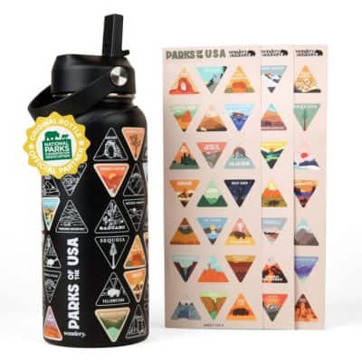
National Parks Water Bottle
A fun way to collect all 63 National Parks!
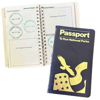
National Parks Passport
Keep track of the parks you’ve visited (with dates!)
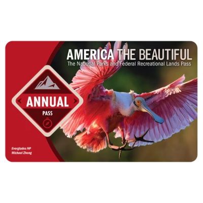
America The Beautiful Park Pass
Frequent visitors save money on entrance fees
6. Queens Garden Trail (2.1 Miles)
Distance: 2.1 miles
Elevation Change: 459 ft
Rating: Moderate
Time Needed: 1-1.5 hours

Queens Garden Trail is another popular Bryce Canyon hike. It’s considered moderate as it’s only 2.1 miles, but includes a 459 foot hike back up to the trailhead along the rim.
Along the trail you are surrounded by tons of hoodoos, including Queen Victoria (the namesake of the trail). Supposedly this hoodoo resembles the real Queen Victoria, but I didn’t see the resemblance.
If you’re looking for the easiest hike into the canyon I think this one is the best. The trail is wide and well-maintained, and the elevation change is moderate without any incredibly steep sections.
7. Navajo Loop and Queens Garden Trail (3 Miles)
Distance: 3 miles
Elevation Change: 649 ft
Rating: Moderate
Time Needed: 1-2 hours

If you have time in your Bryce Canyon itinerary I highly recommend merging Navajo Loop and Queens Garden trails. The combined hikes total 3 miles, and in my experience this is the absolutely best Bryce Canyon hike. Unsurprisingly, it’s also my favorite hike in Bryce Canyon.
With an elevation gain of 649 feet, it’s considered a moderate Bryce Canyon hike. The loop begins at Sunset Point, descends into the amphitheater through iconic and dramatic switchbacks, and then connects with Queens Garden Trail.
TIP: You can hike the loop in either direction, but I recommend starting with Navajo Loop and heading counterclockwise. You’ll descend the steep section first, and then have a milder hike back up to the rim on the Queens Garden trail.

Hard Bryce Canyon Hikes (Under 5 Miles)
If you’re looking for more of a challenge, or want to explore deeper parts of the Bryce Canyon amphitheater then these harder Bryce Canyon hikes will be perfect for your trip!
8. Tower Bridge Trail (3.4 Miles)
Distance: 3.4 miles
Elevation Change: 826 ft
Rating: Moderate
Time Needed: 2-3 hours

Tower Bridge Trail is 3.4-miles and takes you from Sunrise Point deep into the Bryce Canyon amphitheater. It has a significant elevation gain of more than 800 feet, so pack plenty of water because the trail is mostly exposed with very limited shade.
Along this Bryce Canyon hike you’ll pass China Wall, an impressive natural formation that looks like the Great Wall of China.
The trail ends at Tower Bridge, another natural arch formed by erosion.
NOTE: Tower Bridge Trail follows a portion of Fairyland Loop Trail. If you already have plans to hike that Bryce Canyon hike you can skip this trail as it’s redundant.
9. Hat Shop Trail (4.2 Miles)
Distance: 4.2 miles
Elevation Change: 967 ft
Rating: Moderate
Time Needed: 2-3 hours

Hat Shop Trail is a 4.2-mile Bryce Canyon hike that wanders through some really fascinating and unique formations but doesn’t require a super strenuous hike. But that’s not to say it isn’t challenging.
Starting from Bryce Point, this trail descends almost 1,000 feet into the canyon. At the bottom you’ll find the namesake formations: a collection of hoodoos with boulder caps that resemble hats.
Hat Shop is a much less crowded hike in Bryce Canyon National Park, so you will likely have most of the trail to yourself.
10. Sheep Creek & Swamp Canyon Loop (4.4 Miles)
Distance: 4.4 miles
Elevation Change: 892 ft
Rating: Moderate
Time Needed: 2-3 hours

The Sheep Creek & Swamp Canyon Loop is a moderate 4.5-mile hike in Bryce Canyon through some of the less frequented but equally stunning landscapes.
While most people spend time in the amphitheater or near Rainbow Point, this trail is located in the middle and is far less busy.
The trail begins at Swamp Canyon overlook (along the Southern Scenic Drive) and takes you through meadows, pine forests, and along many hoodoos.
Swamp Canyon and Sheep Creek trail is also a great place to spot wildlife in Bryce Canyon.
11. Peek-a-boo Loop Trail (5 Miles)
Distance: 5 miles
Elevation Change: 1,528 ft
Rating: Moderate
Time Needed: 3-4 hours

Peek-a-boo Loop is a 5-mile hike in Bryce Canyon that takes you deep into the heart of the amphitheater. It has a very challenging elevation gain of 1,528 feet, but it’s worth it because this hike has some of the most spectacular views in the park.
This hike starts from Bryce Point before winding through hoodoos and natural “windows” that frame the amphitheater.
Full Day Hikes In Bryce Canyon National Park
The remaining trails on this list of the best hikes in Bryce Canyon National Park are considered hard, and they’re all over 5 miles with at least 1,500 feet in elevation gain. If you’re looking for a challenge then you should consider one of these epic trails!
Additionally, if you’re interested in backpacking Bryce Canyon National Park you can do so on Riggs Spring Loop Trail or Under-The-Rim Trail.
12. Fairyland Loop Trail (7.9 Miles)
Distance: 7.9 miles
Elevation Change: 1,555 ft
Rating: Moderate
Time Needed: 4-6 hours

Fairyland Loop Trail is an enchanting 7.9-mile hike in Bryce Canyon with an elevation gain of over 1,500 feet. It usually takes at least 4 hours to complete this hike, but I would plan for 6 (including snack breaks.)
This trail, which is less popular than other hikes in Bryce Canyon, begins at Fairyland Point (near the park entrance) and wanders through stunning hoodoo formations, with panoramic views that extend over the amphitheater and beyond.
NOTE: The road to Fairyland Point is closed to vehicles during winter in Bryce Canyon, so save this hike for the warmer months, or plan to add an additional 1-mile hike each way from Rt 63 when the road is closed.
13. Riggs Spring Loop Trail (8.6 Miles)
Distance: 8.6 miles
Elevation Change: 1,853 ft
Rating: Hard
Time Needed: 4-6 hours

Riggs Spring Loop is one of the more challenging hikes in Bryce Canyon National Park. It’s 8.6-miles with an elevation gain of 1,853 feet.
The hike starts at Rainbow Point – this is the highest elevation in Bryce Canyon so be extra cautious of dehydration and sun exposure. Luckily, this part of the park has lots of pine trees so this Bryce Canyon hike offers more shade.
The loop routes through the less-visited southern backcountry of Bryce Canyon, so you will probably have the trail mostly to yourself.
TIP: Riggs Spring, located near Riggs Spring backcountry campground, is a fairly reliable water source if you need to refill during your hike. ALWAYS treat water before drinking it, and I highly recommend asking a ranger about the water levels before you head out.
NOTE: There are several backcountry campgrounds along this trail, so it’s a great option if you’re looking to backpack in Bryce Canyon. Keep in mind that backcountry camping in Bryce Canyon requires a permit.
14. Rim Trail (11 Miles)
Distance: 11 miles
Elevation Change: 1,587 ft
Rating: Hard
Time Needed: 5-7 hours

Rim Trail is one of the most accessible and modular Bryce Canyon hikes. The full trail is 11 miles and runs along the rim of the amphitheater. However, there are plenty of stops along the trail where you can catch the Bryce Canyon shuttle back to your starting point.
This hike in Bryce Canyon National Park connects most of the main overlooks along the amphitheater. It begins at Fairyland Point and ends at Bryce Point, but you can start in the middle, do shorter sections, and customize this hike however you’d like.
15. Under-the-Rim Trail (22.4 Miles)
Distance: 22.4 miles
Elevation Change: 4,366 ft
Rating: Hard
Time Needed: 12+ hours

Under-the-Rim is the longest Bryce Canyon hike, stretching 22.4 miles through the park’s backcountry. It also has substantial elevation gain over 4,300 feet.
For reference, hiking into the Grand Canyon is around 5,000 feet of elevation gain so Under-the-Rim Trail is similar in challenge to Bright Angel or South Kaibab.
The trail runs from Rainbow Point to Bryce Point. However, Rainbow Point is higher in elevation so if you begin there you’ll have less overall incline than if you were to hike it in reverse, starting at Bryce Point.
You can also tackle this trail in shorter sections, or turn it into an overnight backpacking trip in Bryce Canyon.
NOTE: If you choose to do shorter sections of this trail you will need to hike out-and-back, or have your return transportation planned for a point-to-point hike because the shuttle does not run along this portion of Bryce Canyon.
Where To Stay Near Bryce Canyon National Park
There are three options for staying in Bryce Canyon National Park and several options for hotels and vacation rentals nearby.
The best place to stay in Bryce Canyon National Park is The Lodge At Bryce Canyon, which is the only hotel on the property.
There are also two campgrounds. North Campgrounds is open year-round and Sunset Campgrounds is only open during the summer.
If you’d prefer to stay outside the park, I recommend Bryce Canyon City, which is just outside the entrance gate:
- Ruby’s Inn – lower mid-range
- Bryce View Lodge – mid-range
- Bryce Canyon Grand Hotel – luxury
- Quality Inn – budget (but slightly farther away)
- Vacation Rentals Near Bryce Canyon
Best Time Of Year For Hiking In Bryce Canyon National Park
Personally, I think the best time to visit Bryce Canyon is in the spring or fall. The weather is perfect for hiking and you’ll have fewer crowds. My most recent trip was in October and we had fantastic weather for hiking in Bryce Canyon!
Spring In Bryce Canyon
During early spring in Bryce Canyon (March & April) the weather is still fairly cold, and can drop below freezing at night. Because Bryce Canyon is located at higher elevation (8,000+ feet) it tends to stay cooler than other National Parks in Utah year-round.
It’s also considered to be a high desert, so you should anticipate large temperature fluctuations between day and night. As soon as the sun sets the temperatures can drop by as much as 40°F (although 20°F changes are more common.)
Depending on the week you travel you may experience larger crowds, especially during Easter week and popular spring break weeks. Utah schools tend to have spring break in mid-March.
NOTE: The Bryce Canyon shuttle only runs from April – October.
Summer In Bryce Canyon
While I don’t think summer is the best time to visit Bryce Canyon, it’s still feasible (especially if you’re working around school breaks.)
Be aware that July – September is the rainy season, so you may be limited in which Bryce Canyon hikes you can complete due to flash flooding, wash out or rock slips.
Fall In Bryce Canyon (Best Time For Hiking)
I recommend visiting Bryce Canyon in October or November. You’ll still have great weather for hiking, and hardly any crowds.
This is also the perfect time to see the other Utah National Parks, which tend to be unbearably hot during the summer months.
If you’re planning to see Zion and Bryce Canyon, fall is definitely the best time to visit.
Winter In Bryce Canyon
Bryce Canyon in winter can also be a great time to visit. Due to its high elevation temperatures rarely get above high-30’s during the day. Snow is common in Bryce Canyon, although it rarely accumulates.
Be sure to check out my winter hiking essentials before planning your trip to Bryce Canyon!

Save this article
Enter your email address and I’ll send it straight to your inbox!
You’ll also receive my monthly newsletter filled with helpful National Park planning tips.
Additional Resources For Planning A Trip To Bryce Canyon
- Bryce Canyon National Park Itinerary And Travel Guide
- One Day In Bryce Canyon National Park Itinerary
- Zion To Bryce Canyon National Park Road Trip (+ Map)
🚐 Rent a Campervan for your National Park road trip here!