Page To Grand Canyon Road Trip Itinerary
While the drive from Page to Grand Canyon National Park is under 3 hours, there’s a surprising number of fun things to do along the route.
This road trip is a perfect addition to your Grand Canyon itinerary, or if you’re looking to complete the Grand Circle Road Trip (a loop trip to 6 National Parks in Arizona and Utah.)
If you’re short on time, I recommend stopping at Horseshoe Bend and Antelope Canyon on your trip from Page to Grand Canyon. With more time, add Monument Valley and Toadstool Hoodoos or any of the other stops listed below!
In this article:
- Best stops from Page to Grand Canyon
- What to do in Page and Grand Canyon
- Printable road trip itinerary
- Tips for travel & where to stay
Disclaimer: This article features some affiliate links. I only endorse things I’ve personally used or that come highly recommended by trusted peers. If you purchase anything I mention using my referral links from Amazon, REI or other retailers I may receive a small commission. However, there is never extra cost to you. You can read more here. Thank you for your support.
Page To Grand Canyon Map
• Distance From Page To Grand Canyon: About 1.5 hours to drive (110 miles)
• Route From Page AZ To Grand Canyon South Rim: Take US-89 South to Cameron, then turn west onto AZ-64 toward the South Rim. The drive is scenic, with a many points of interest along the way.
Use this map to plan your road trip from Page Arizona to Grand Canyon National Park! I’ve labeled items by activity type (noted by icon).
How To Use This Map:
1. To open in a new tab, click [] in the top right corner of the map.
2. To save to your Google Maps account, click ☆ (you must be signed in to Google).
3. To use during your trip, open Google Maps on your phone, select “You” from the bottom bar, scroll down and click the maps icon for a list of your saved custom maps.
Page To Grand Canyon Itinerary
I think the best itinerary for this trip is to spend two days in Page, followed by one day driving from Page to Grand Canyon.
Grand Canyon south rim can be seen in a day, but ideally you’ll have two or three days so you can see everything along the rim, scenic drives and hike down into the canyon.
Best Stops From Page To Grand Canyon
For a relatively short drive from Page to Grand Canyon (just under 2 hours to the East entrance), there’s a surprising number of things to do along the route.
This drive is pretty easy, and incredibly scenic. You can do it in an afternoon, or spend the whole day exploring (which is what I recommend!)
There are also several fantastic bucket list hikes along this road trip, but I’ll cover those in the next section.
Explore Antelope Canyon

Time Needed: 2 hours
Cost: $70 – $125 per person
Reservations: pre-booking recommended
Ok, technically Antelope Canyon is a hike, but it requires a guided tour so I’m placing it in the “things to do” category!
Antelope Canyon is one of the most popular things to do in Page Arizona, and for good reason! You definitely do not want to skip this!
The famous deep red and orange slot canyons attract visitors from all over the world. However, in order to visit Antelope Canyon you will need to book a tour. The land is owned by the Navajo Nation, and independent entry is forbidden.
There are three locations in Antelope Canyon that offer tours:
Lower Antelope Canyon, Upper Antelope Canyon and Antelope Canyon X.
While they’re all relatively similar, there are a few noteworthy differences in these canyon locations:
- Lower Antelope Canyon (Book Here) – narrower at the bottom and widens out towards the top.
- Upper Antelope Canyon (Book Here) – wider at the bottom and narrower at the top.
- Antelope Canyon X (Book here) – has the tallest slot canyons, and it tends to be the least crowded.
Antelope Canyon land belongs to the Navajo Nation, and the tours are run by Indigenous guides to help protect the land. Tours typically cost anywhere from $70 to $125 per person.
There is one exception to the tour requirement, though. Entry from the water is allowed, so you can rent a kayak from Antelope Point Marina.
It’s approximately 2 miles to reach Antelope Canyon from the boat launch.
Guided kayaking tours to Antelope Canyon are also available.
Visit Rainbow Bridge National Monument

Time Needed: 7 hours
Cost: $120+ per person
Reservations: pre-booking recommended
Rainbow Bridge National Monument is one of the largest known natural bridges in the world, located on Lake Powell. It rivals even the largest arches in Arches National Park.
But, there are only two ways to get there: by boat, or a 26+ mile hike.
The most popular way to get to Rainbow Bridge is by boat. Not a big surprise (lol), considering the alternative is a multi-day trek.
Lake Powell Resorts & Marinas offer boat tours, which take around 7 hours, depending on water levels.
From the boat dock, there is a two-mile round trip hike to the base of Rainbow Bridge, but the exact distance also depends on the lakes water levels.
Private boats are also permitted to dock at Rainbow Bridge, including private boat rentals. The fee for docking is $30 per boat.
Alternatively, you can hike or backpack to Rainbow Bridge, but it requires strong navigation and backcountry skills.
There are two trail options:
North Trail is 30-miles round trip, and South Trail is 27-miles round trip.
You’ll also need a permit to hike, as both trails are located within Navajo Nation.
Rainbow Bridge is a sacred site and holds spiritual significance for local Native American tribes. To show respect to the significance of this land please do not climb or stand on the arch.
Boat On Lake Powell

Time Needed: 2+ hours
Cost: $145+
Reservations: pre-booking recommended
Lake Powell is a huge reason people visit Page, Arizona. It’s a massive reservoir with water activities like boating, kayaking and paddleboarding.
I’ve even rented a houseboat on Lake Powell for a week, which was incredibly fun!
You can spend an afternoon on Lake Powell, or several days. I recommend booking an evening dinner cruise on Canyon Princess to see Lake Powell at sunset.
Glen Canyon Dam Overlook

Time Needed: 1 – 2 hours
Cost: free
Reservations: none
Glen Canyon Dam Overlook is just 5 minutes from Page, along US-89. It’s located within Glen Canyon National Recreation Area along the Scenic View Drive.
There’s a short (0.2 miles total) but steep trail that leads to the viewpoint overlooking the Glen Canyon Dam and the Colorado River.
From the same parking area you can take another trail to the Colorado River Viewpoint (0.8 miles total). The view from here is spectacular, especially when you consider how many millions of years it took for the river to carve through the rock layers.
Glen Canyon Dam is so impressive – it’s the second largest concrete arch dam in the United States. Hoover Dam is only larger by 16 feet.
Horseshoe Bend, Rainbow Bridge, Lake Powell and Lee’s Ferry are also located within Glen Canyon National Recreation Area, although it’s a huge area covering over 1.25 million acres.
The Secret Cave Behind Shell Gas Station

Time Needed: 20 minutes
Cost: free
Reservations: none
This is a fun one! There’s a Shell gas station on Coppermine Road in Page that has a secret hidden cave.
Directly behind the gas station is a small opening that leads into a beautiful sandstone cave chamber.
Is it the most epic arch in the southwest? No. But as far as refueling stops go, it’s a fun, off-the-beaten-path thing to do in Page Arizona on your way out of (or in to) town!
Address: 1501 Coppermine Rd, Page, AZ
Quick Stop At Antelope Pass Vista

Time Needed: 20 minutes
Cost: free
Reservations: none
Antelope Pass Vista is a quick stop just 20-minutes south of town as you head from Page to Grand Canyon National Park.
The road ascends towards the high desert plateau and from here you can see a sweeping view of the desert valley below, with dramatic red rocks, sagebrush, and colorful desert terrain.
It’s a quick pull-off, but one you won’t want to miss!
Detour To Lee’s Ferry

Time Needed: 1 – 3 hours
Cost: Glen Canyon National Recreation Area entrance fee, $30/vehicle for one week
Reservations: none
Lee’s Ferry is a fun stop on your drive from Page to Grand Canyon. It takes about 45 minutes to reach from Page, so it’s a good way to break up the drive.
You’ll need to detour slightly to reach Lee’s Ferry. The route takes you through Marble Canyon which is incredibly scenic. In total, the detour adds about 20-minutes in each direction.
Historically, Lee’s Ferry was important for pioneers heading West because it was the only place for nearly 700 miles where it was possible to both access and cross the raging Colorado River.
Today, it’s still difficult to access the Colorado River by car in most of this area due to the massive rock walls that flank the river and prevent road access. That means Lee’s Ferry is the only place where you can launch a boat into the Colorado River for hundreds of miles.
There’s also a very neat slot canyon hike in this area. Cathedral Wash Trail is only 3.3 miles out-and-back, but requires a bit of a scramble in some sections (especially at the start of the trail).
NOTE: Hiking in slot canyons can be dangerous, so make sure you’re aware of the weather forecast. Rain can lead to deadly flash flooding. If any rain is predicted in the area (or surrounding areas), skip this hike.
The trail to Cathedral Wash can be tricky to follow, and it’s not always well marked. I highly recommend downloading the offline AllTrails map ahead of time.
NOTE: You’ll need an AllTrails+ membership to use their offline maps (you can use code EVERYWHERE30 for 30% off your annual membership, regularly $36/year.)
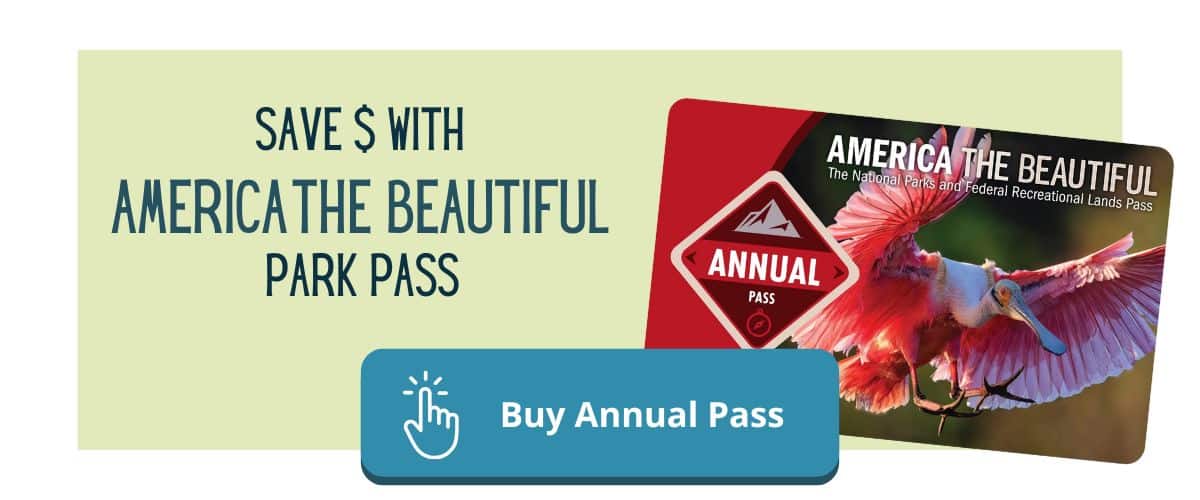
There is a $30/vehicle entrance fee for Glen Canyon National Recreation Area. However, if you have an annual America The Beautiful National Parks pass ($80/year) entry is free.

TIP: The annual National Parks pass is a great money-saving option for a road trip from Page to Grand Canyon. Between Grand Canyon ($35 entrance fee) and Glen Canyon National Recreation Area ($30 entrance fee) you’ll spend $65. The annual pass is just $80 and gets you access to these areas for free, plus any additional parks (over 2,000!) you visit for the rest of the year!
Stop By Navajo Bridge

Time Needed: 20 minutes
Cost: Glen Canyon National Recreation Area entrance fee, $30/vehicle for one week
Reservations: none
Navajo Bridge is also located on the same short detour to Lee’s Ferry. You’ll cross the bridge on your way to Lee’s Ferry, which is located in the center of Marble Canyon.
The bridge was completed in 1929, and basically put Lee’s Ferry out of business. Instead of the dangerous river crossing, travelers could safely cross the Colorado River by bridge instead.
A more modern vehicle bridge was constructed in 1995. Now, the original bridge is a pedestrian-only bridge with great views of the river below.
This is a great place to take a short break to stretch your legs and check out the bridge. The coolest part of this stop are the endangered California Condors.
They’re extremely rare, extremely massive birds, and you have a good chance to spot them here as it’s one of the highest concentrations of California Condors in the US.
The only other place I’ve spotted California Condors was on a recent trip to Zion National Park, while hiking Angels Landing. They’re also supposed to be fairly prevalent in Pinnacles National Park, but I wasn’t lucky enough to see one during my visit.
Find Dinosaur Tracks At Navajo Moenave

Time Needed: 1 – 2 hours
Cost: donation-based
Reservations: none
Want to see 200 million year old dinosaur tracks? You’re in luck! Navajo Moenave is an hour south of Page and showcases some incredibly well preserved dinosaur tracks, tail drags, and other interesting prehistoric formations.
Navajo Native’s offer guided tours to show you the tracks, as well as share interesting history about the Jurassic period, how the tracks were discovered, and geological explanations about their formation.
While the site is free to visit, donations are appreciated for guided tours and the preservation of the site.
Grab Taco’s At Cameron Trading Post
The Cameron Trading Post is a highlight for a road trip from Page to Grand Canyon. It’s located on US-89 just before the turn-off towards Grand Canyon.
Established in 1916, it was originally a market for Navajo and Hopi locals to trade their goods. Today, it’s a popular gift shop, restaurant, gallery, and hotel.
In the gift shop you can find jewelry, pottery, rugs, and art. The real appeal is the restaurant, though!
The reason this stop is famous is for their Navajo Tacos. Green Chili is also a popular menu item.
Little Colorado River Gorge Overlook

Time Needed: 20 minutes
Cost: $9
Reservations: none
About two hours into your drive from Page to Grand Canyon you’ll come across Little Colorado River Gorge Overlook. It’s a smaller canyon that gives you a preview of what you’re about to see as you drive into Grand Canyon National Park.
This spot holds cultural significance to the Navajo people, and is still managed by the Navajo Nation.
Local native vendors sell their crafts and art here, so it’s a great spot to look for unique gifts and souvenirs from your trip.
The Navajo Nation charges a fee to enter this area, which helps them maintain their sacred lands. However, the fee seems to change a bit (sometimes $9, sometimes donation based) and often-times there is no one there to collect a fee.
Best Hikes From Page To Grand Canyon
If you have a full day (or longer!) to explore the route from Page to Grand Canyon, there are some bucket list worthy hikes to add to your itinerary!
The New Wave (Alternative To The Wave)

Time Needed: 1 – 2 hours
Cost: Glen Canyon National Recreation Area entrance fee, $30/vehicle for one week
Reservations: none
You may have heard of The Wave – a popular hiking trail in Paria Canyon, along the Utah and Arizona state line. It’s so popular that you can only hike it with a permit, and they’re some of the hardest hiking permits to get in the US. (The Wave is covered later on in this article!)
The New Wave is a great alternative option for a trip from Grand Canyon to Page because it’s closer, and you don’t have to win a permit lottery.
It’s just 5 minutes from downtown Page, and is a smaller but intricate sandstone formation like the Wave. It’s also free to explore!
The two hikes are actually only about 25 miles apart (as the bird flies), so geologically they’re relatively similar.
There isn’t much shade along the trail, so I recommend hiking it early in the day, before the heat, bringing plenty of water and packing a wide-brimmed sun hat.

Hanging Gardens Trail

Time Needed: 1 – 2 hours
Cost: Glen Canyon National Recreation Area entrance fee, $30/vehicle for one week
Reservations: none
Hanging Gardens Trail is a fairly easy 1.4 mile round trip hike, just across the river from The New Wave. The trail meanders through desert terrain and ends at a lush oasis of green plant life that’s sustained through the natural springs in the area.
Most of the trail is exposed, so this is another good hike for early morning or late evening when the sun isn’t so intense.
Horseshoe Bend

Time Needed: 1 – 2 hours
Cost: $10 parking fee
Reservations: none
Horseshoe Bend is located just 10 minutes south of town and is one of the most popular things to do in Page, Arizona.
The viewpoint from the overlook offers a stunning view of the Colorado River below, as it curves around sandstone cliffs (resembling… you guessed it! a horseshoe)
From the parking area, it’s a 0.8 mile (one-way) hike down to the viewpoint. The trail is easy with mild elevation change, but you head downhill first so be prepared to hike back up after.
During the summer, it can get quite hot here, so going earlier in the day is ideal.
To avoid the crowds I recommend going for sunrise or during a weekday, if you can.
Sunset is also a really popular time to visit, but you’ll want to arrive a 45-minutes to an hour early so you can find parking and deal with the crowds.
Since it became instagram famous the crowds have exploded. For that reason, a $10 admission fee is now charged (per vehicle). This fee is specific to the parking area for Horseshoe Bend (owned by the City of Page), and not for the entire park (which is actually part of Glen Canyon National Recreation Area.)
Waterholes Canyon (Alternative To Antelope Canyon)

Time Needed: 2 hours
Cost: $125/person
Reservations: pre-booking recommended
Waterholes Canyon is a unique thing to do on a road trip from Grand Canyon to Page Arizona, just a few miles from Horseshoe Bend.
Like Antelope Canyon, it’s a stunning slot canyon with bold red walls and intricate patterns. However, it’s lesser known and tends to have fewer crowds.
While this trail, located within Navajo Nation, used to be open to the public, you now need a pre-booked tour to explore Waterholes Canyon.
Hikes are typically 2-miles and take about an hour and a half to complete.
<< Read More: Best Hiking Gear For Beginners On A Budget >>
Where To Stay In Page Arizona
Page, Arizona is a relatively smaller town. You’ll likely have your own vehicle or a rental car because most of the things to do from Page to Grand Canyon National Park aren’t easily accessible by public transportation.
For that reason, you don’t necessarily need to stay in downtown Page. It may be more convenient to be able to walk to dinner, but if you’re looking for a deal you’ll find better prices a few miles outside of downtown.
Where To Stay In Page Arizona:
- Clarion Inn Page – mid-range (central downtown)
- Hyatt Place Page – upper mid-range & pet friendly (central downtown)
- Lake Powell Resort – budget-friendly with lake views
- Under Canvas – unique glamping experience
- Tiny Home Cabin – vacation rental
Short Detours To Include On Your Drive From Page To Grand Canyon
These stops aren’t along the route from Page Arizona to Grand Canyon, but they’re so incredible and worth adding to your itinerary if you can squeeze them in!
Oljato Monument Valley

Time Needed: Half day
Cost: $8/person to self-drive, $85/person for a guided tour
Reservations: pre-booking recommended for guided tours
Straddling the border of Arizona and Utah, Monument Valley is located on US-163, about 2 hours from Page, Arizona.
It’s famous for its massive red sandstone buttes and mesas that rise dramatically from the desert floor. The landscape has been featured in countless TV shows and films, but it’s most famously known from Forrest Gump.

Monument Valley Scenic Drive is a 17-mile loop that takes you through the valley. It offers stunning viewpoints where you can stop for photos and take in the vast, iconic landscape.
There’s an entrance fee of $8 per person, which helps support the Navajo Nation and the preserve of the land.
NOTE: The scenic drive through Monument Valley is on a dirt road. You’ll want a high clearance vehicle for this trip, and if it’s recently rained I highly recommend a 4×4 vehicle.
It’s also really important to make sure your rental car agreement allows you to drive on dirt roads (many exclude non-paved roads).
Alternatively, you can book a guided tour if you don’t have a suitable vehicle to drive yourself.
TIP: For overnight trips, the most convenient place to stay in Monument Valley is The View Hotel which is located inside of the park. Desert Rose Resort & Cabins is another good nearby option.
The Wave

Time Needed: 4 – 6 hours
Cost: $6 lottery fee, add’l $7/hiker fee if permit is awarded
Reservations: advanced permits recommended, some day-of permits available
The Wave is about 45 minutes west of Page, AZ, along House Rock Valley Road (off US-89).
It’s a world-famous sandstone formation with mesmerizing, wave-like patterns of red, orange, and yellow. In addition to the swirling sandstone stripes you’ll also see dinosaur tracks along this hike.
However, it’s very difficult to secure permits for hiking this trail.
Access to The Wave is limited to 64 permits per day (48 available through an online lottery, 16 through an in-person lottery). I know people who have tried for years and still not been successful in getting a permit for this hike.
The trail is about 6.8 miles long, and while not physically difficult, it can be exceptionally hard to navigate and the full sun exposure can dehydrate you quickly.
TIP: Download the AllTrails map ahead of time. You’ll need an AllTrails+ membership to access maps offline, which is $3/month or $36 annually (you can save 30% on annual memberships with code EVERYWHERE30)
Toadstool Hoodoos

Time Needed: 1 – 2 hours
Cost: free
Reservations: none
Toadstool Hoodoos is only 30 minutes west of Page, AZ, near Big Water, Utah. The trail showcases unique mushroom-shaped rock formations created by centuries of erosion.
There’s a popular 1.7 mile hike through the hoodoos. The trail is rated as easy and has a very modest elevation gain. While the parking area is fairly small, it’s usually not busy.
If your trip includes Zion or Bryce Canyon, both The Wave and Toadstool Hoodoos are directly along the route!
Grand Canyon National Park
When driving from Page to Grand Canyon the fastest way into the park is through the Desert View Entrance on the east side.
This isn’t the primary entrance to the park, so it’s typically less busy with fewer lines to enter the park gates (which is good news for you, because the main entrance can get absolutely mobbed in the summer.)
Entrance to Grand Canyon National Park is $35 per vehicle (good for 7 days). You can also enter for free with an America The Beautiful National Park Pass.
Best Things To Do In Grand Canyon National Park
By entering Grand Canyon from the east, you’ll drive along the scenic road (Desert View Drive), following the South rim, with many great viewpoints.
Desert View Drive Viewpoints
in order from the east entrance to Grand Canyon Village
✨Desert View Watchtower✨
Navajo Point
✨Lipan Point✨
Tusayan Museum & Ruin
Moran Point
Buggeln (picnic area)
✨Grandview Point✨
Grandview Point, Lipan Point and Desert View Watchtower are must-see stops!
Desert View Drive is 23 miles long, and it will take you into the heart of Grand Canyon Village.
There are no shuttles that run along this road, so it tends to be far less chaotic. While parking is limited at some of the viewpoints, most people are only staying for a few minutes so spots tend to turn over really quickly.
Plan to spend 1 – 2 hours driving the scenic road and exploring the stops. Once you arrive in Grand Canyon Village, you can park your vehicle and explore by foot or with the free shuttle.
TIP: Download this self-guided driving tour before your trip! It’s just like having a tour guide to point out landmarks, interesting history, geological explanations, etc — except for a fraction of the cost (less than $20), on your own schedule and without any crowds.
Once you download it to your phone, the guide uses your GPS signal to automatically play whenever you’re near a landmark, so it still works even without cell service. You can listen from your own vehicle or while riding the shuttle.
Some of the best things to do in Grand Canyon south rim include walking the Rim Trail, biking along Hermit Road, booking a scenic helicopter ride, and hiking some or all of Bright Angel (15.8 miles) into the canyon.
For a detailed overview of how to spend 1 to 3 days in Grand Canyon National Park check out my itinerary here.
Where To Stay At Grand Canyon National Park
Personally, I think staying inside the park is the most convenient option for a trip to Grand Canyon. You’ll be within walking or shuttle distance to everything on the south rim, so you won’t have to deal with parking or long lines at the entrance gate.
The best places to stay in Grand Canyon National Park:
- Yavapai Lodge – pet-friendly
- El Tovar Hotel – luxury lodge with stunning canyon views
- Bright Angel Lodge – more affordable in-park lodging
If you’re booking last minute, it can be tricky to find in-park options. Luckily, there are several great options just a few miles past the entrance gates. (Just be prepared for long lines to enter the park during spring break and summer vacation.)
The best places to stay near Grand Canyon:
- The Grand Hotel – mid-range rustic lodge with modern amenities
- Red Feather Lodge – comfortable, budget-friendly lodge
- Tiny Home Cabin – vacation rental
- Off-Grid Tiny Home – vacation rental
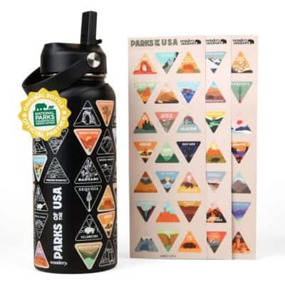
National Parks Water Bottle
A fun way to collect all 63 National Parks!
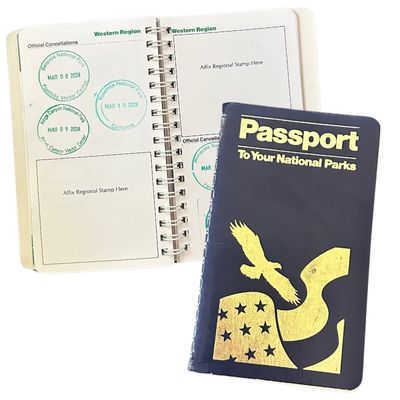
National Parks Passport
Keep track of the parks you’ve visited (with dates!)
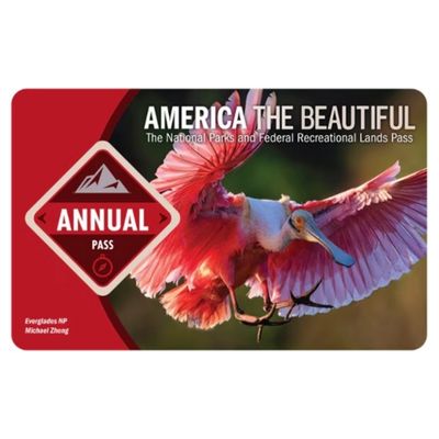
America The Beautiful Park Pass
Frequent visitors save money on entrance fees
Tips For Driving From Page To Grand Canyon
There’s a few important things to keep in mind before you begin your drive from Page to Grand Canyon.
Changing Timezones
Most importantly, Arizona has weird timezones. While Arizona does not observe daylight savings time, Navajo Nation does.
If your trip falls between March and November you will regain an hour when you leave Navajo Nation.
Navajo Nation occupies most of northeastern Arizona, but does not include Page. It’s western border is the Colorado River, so activities like Lee’s Ferry and Marble Canyon follow regular Arizona time.
Most of the activities south of Page, but east of the river are on Navajo Nation. It’s best to double check all of your reservations to make sure you’re arriving at the correct time!
Limited Services
Next, there are some remote stretches along the drive from Page to Grand Canyon. Make sure your gas tank does not get too empty, and always have a plan for when you’ll be able to refuel.
While cell service has improved significantly, there are still spots with limited cell coverage. Some remote areas only have LTE — which means you can place a phone call but you won’t have any data for things like maps and directions.
I always download an offline map in Google Maps for my road trips. The map data is stored locally on your phone so you can access driving directions, gas stations, store hours etc. It’s also a good way to use less data and avoid overages while traveling.
Great Route For Campervans
I’ve traveled all over the US, Canada and Mexico in my campervan. By far, the easiest place to travel this way is Arizona and Utah.
There are so many great (free!) places to camp and I love the flexibility of having my bed and kitchen with me everywhere I go!
If you’ve been ogling van life, this would be a great road trip to give it a try!
🚐 Plan The Ultimate Road Trip In A Campervan
Are you curious about van life? This trip is the perfect route to give it a try!
Outdoorsy is a great peer-to-peer campervan rental site (like Airbnb) with tons of van layouts and prices across the US! Native Campervans is great if you prefer to rent from a company with 24/7 roadside assistance for peace of mind.
Not sure about where to park for the night? Don’t stress!
Download my Guide To Finding Free Campsites e-book or checkout The Dyrt to find unique stays.
Page To Grand Canyon FAQs
Additional Resources For Planning Your Trip From Page To Grand Canyon National Park
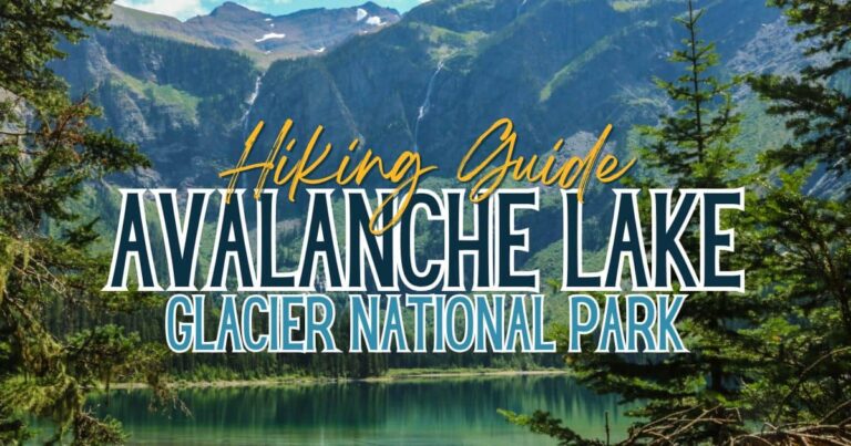
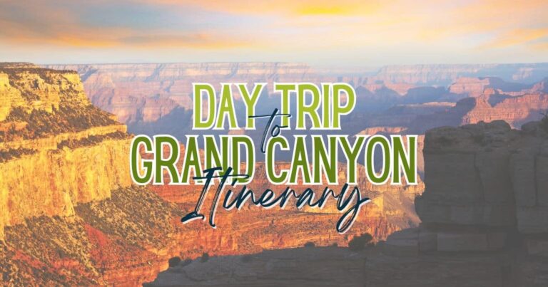
- 1 – 3 Day Trip To Grand Canyon Itinerary
- Road Trip Itinerary: Grand Canyon To Zion National Park
- Moab To Grand Canyon Road Trip Itinerary
- Las Vegas To Grand Canyon By Car: Road Trip Itinerary
- Road Trips From Las Vegas – 14 Epic Destinations
Travel Planning Resources
These are the resources I use and recommend for planning your next trip:
Accommodations: Expedia (hotels), VRBO (vacation rentals)
Flights: Skyscanner
Rental Cars: DiscoverCars and Outdoorsy
Tours & Excursions: Viator and GetYourGuide
Travel Insurance: SafetyWing
Credit Card With Travel Points: Chase Sapphire Preferred