Las Vegas To Arches National Park Road Trip Itinerary
The route between Las Vegas to Arches National Park is one of my favorites – there are several incredible National Parks and scenic stops along the way. Even though the distance is over 10 hours, I promise you won’t be bored on this road trip. The trip can be broken up into shorter drive days with National Parks sprinkled in between.
This route includes Zion and Bryce Canyon – two of my favorite US National Parks! You’ll be able to complete the Utah Mighty 5 on this road trip – that’s all 5 National Parks in Utah (Zion, Bryce Canyon, Capitol Reef, Canyonlands and Arches).
In this article:
- What To Do In Vegas
- Highlights & Recommended Itinerary For Zion, Bryce Canyon, Capitol Reef, Canyonlands & Arches National Parks
- The Best Stops Along The Route From Las Vegas To Arches National Park
- Where To Stay
- Free downloadable road trip map
Disclaimer: This article features some affiliate links. I only endorse things I’ve personally used or that come highly recommended by trusted peers. If you purchase anything I mention using my referral links from Amazon, REI or other retailers I may receive a small commission. However, there is never extra cost to you. You can read more here. Thank you for your support.
How to Get from Las Vegas to Arches National Park
There are two routes from Las Vegas to Arches National Park – the direct route and the scenic route.
The direct route from Las Vegas to Arches is only 6.5 hours, and follows I-15N and I-70E. If you’re short on time this is the fastest way to get to Arches National Park from Las Vegas, but you’ll miss Bryce Canyon and Capitol Reef.
However, if you’re up for an epic road trip itinerary then I highly recommend you take the scenic route from Las Vegas to Arches. This article focuses on an itinerary along the scenic route.
What is the Most Scenic Route to Arches National Park?
The scenic route from Las Vegas to Arches takes about 10 hours to drive, and primarily follows scenic byway 12 through Utah.
This route takes you to all of the Utah Mighty 5 National Parks: Zion, Bryce Canyon, Capitol Reef, Canyonlands and Arches.
You’ll also pass through Dixie National Forest, Red Canyon, Escalante and Goblin Valley State Park before arriving in Moab, Utah.

Recommended Itinerary: Las Vegas To Arches National Park
There’s a lot of ground to cover on this road trip from las Vegas to Arches National Park so I recommend at least a full week (weekend to weekend – 9 days), but ideally 11 days.
Here’s how I would break down this itinerary for 9 and 11 days:
9 Day Itinerary
- Day 1: Arrive in Las Vegas in the morning and head towards Zion, exploring stops along the route
- Day 2-3: Zion National Park
- Day 4: Drive from Zion to Bryce Canyon National Park + stops along the route, spend the evening in Bryce Canyon National Park
- Day 5: Spend the morning in Bryce Canyon before driving to Capitol Reef + stops along the route.
- Day 6: Spend the morning in Capitol Reef before driving to Moab + stops along the route.
- Day 7: Canyonlands National Park
- Day 8: Arches National Park
- Day 9: Return to Las Vegas (or do a point-to-point trip up to Salt Lake City)
11 Day Itinerary
- Day 1: Arrive in Las Vegas in the morning and spend the day sightseeing
- Day 2: Drive from Las Vegas to Zion National Park + stops along the route
- Day 3-4: Zion National Park
- Day 5: Drive from Zion to Bryce Canyon National Park + stops along the route
- Day 6: Bryce Canyon National Park
- Day 7: Drive from Bryce Canyon to Capitol Reef + stops along the route. Spend the afternoon in Capitol Reef
- Day 8: Drive from Capitol Reef to Canyonlands + stops along the route. Spend the afternoon in Canyonlands and stay in Moab, near Arches
- Day 9-10: Arches National Park
- Day 11: Return to Las Vegas (or do a point-to-point trip up to Salt Lake City)
Save this article
Enter your email address and I’ll send it straight to your inbox!
You’ll also receive my monthly newsletter filled with helpful National Park planning tips.
Las Vegas To Arches National Park Map
Use this map to plan your itinerary from Las Vegas to Arches National Park! I’ve labeled items by day (noted by color) as well as by activity type (noted by icon).
How To Use This Map:
1. To open in a new tab, click [] in the top right corner of the map.
2. To save to your Google Maps account, click ☆ (you must be signed in to Google).
3. To use during your trip, open Google Maps on your phone, select “You” from the bottom bar, scroll down and click the maps icon for a list of your saved custom maps.
Las Vegas National Park Road Trip
I always recommend Las Vegas as the best starting location for any road trip in the Southwest.
It’s conveniently located, has a great airport that’s easy to get to and from, and it typically has the best flight and rental car prices.
Find the best flight prices for Las Vegas here.
Compare rental car prices for Vegas here.
For this road trip, you might also consider renting a campervan instead of getting a rental car and hotel accommodations. This is a fantastic route for campervans (coming from someone who traveled and lived in hers for several years!)

Best Things To Do In Las Vegas
If you’ve never been to Las Vegas before, it’s worth spending a day exploring. However, I think that the best parts of this road trip are the National Parks, so I recommend prioritizing time in the parks over staying in Vegas for more than 24 hours.
There are a few iconic things to do in Las Vegas in just one day.
Check out a show – Vegas is famous for them! Some popular options are Cirque Du Soleil, Blue Man Group and David Copperfield.
Personally, I think Cirque Du Soleil is the best show in Vegas!

There are also plenty of free things to do in Las Vegas!
Stroll through the Venetian, there are shops and restaurants lining the canal – it’s all indoors but it looks and feels like you’re in Italy. You can even take a Gondola ride on the canal.
After, head over to the Bellagio fountains. The fountains are just outside of the hotel and are synced with music. It’s quite a display, and a great place to people watch.
Finally, one of the best ways to see Las Vegas on a short trip is on a sightseeing bus. The night buses are especially great because you’ll be surrounded by the iconic Vegas lights.
Vegas Hotels
There’s an abundance of hotels to choose from in Vegas.
If you stay on the strip you’ll be conveniently close to everything. I love the Cosmopolitan (a swanky vibe) and The Venetian (has spacious rooms!) – I’ve personally stayed at both. Other iconic options include the Bellagio, and Encore.
If you’re looking for a less chaotic vibe I recommend staying near Fremont Street, a 6-block, pedestrian only area in downtown Vegas.
There are a lot of things to do and see within walking distance. Great hotels near Freemont Street include Downtown Grand Las Vegas and the Plaza Hotel.
Las Vegas To Zion National Park
Highlights:
- Lake Mead National Recreation Area
- Valley Of Fire State Park
- Grafton Ghost Town
The distance from Las Vegas to Zion National Park is 2 hours and passes through some interesting locations, like Lake Mead National Recreation Area, Valley Of Fire State Park and Grafton Ghost Town.
I recommend getting an early start and spending most of the day exploring along the route, before arriving in Springdale (near Zion) in the evening.
Lake Mead National Recreation Area
Just outside of Las Vegas is Lake Mead National Recreation Area. You’ll also find the Hoover Dam here.
Guided tours of the dam are available if you want to go inside the structure. Otherwise, you’re able to walk on top of it for free.
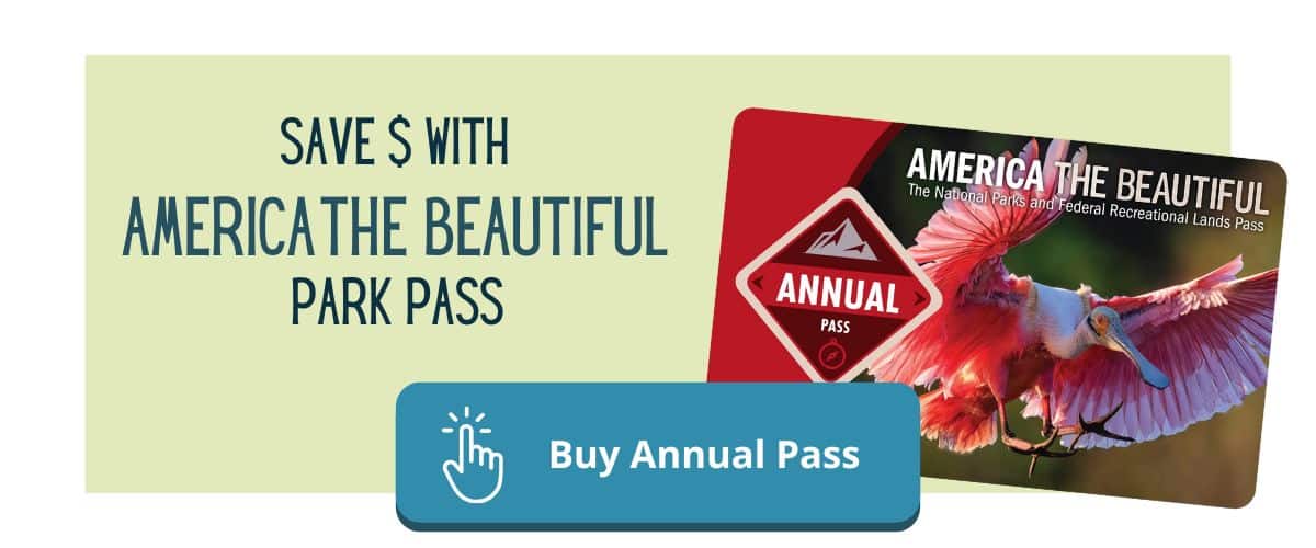
America The Beautiful National Park Pass
Lake Mead National Recreation Area charges $25 admission per vehicle. If you have an America The Beautiful Park Pass your entry is free.
The pass is $80 and good for 12 months. Most parks charge $30-35 for entry, so the pass saves you money with the third park you visit.
I recommend you get the America The Beautiful Park Pass if you’re going to visit more than 2 National Parks (or National Recreation Areas) within a 12 month period.
With this itinerary you’ll save on admission at Lake Mead, Zion, Bryce, Capitol Reef, Canyonlands and Arches. In total, admission for the parks on this road trip cost $175.
You only need one America The Beautiful Park Pass per vehicle. One pass gets everyone in that vehicle into the park for free.
Valley Of Fire State Park
Just outside of Lake Mead National Recreation Area is Valley Of Fire State Park. This is one of the coolest state parks I’ve visited, and it’s definitely worth spending a few hours in.
It’s known for stunning red sandstone formations, ancient petroglyphs, and unusual desert landscapes. I imagine this is what it feels like to walk around Mars.
This is a great place to take a few short hikes and explore. I recommend at least one of these hikes:
- Fire Wave and Seven Wonders Loop (1.9 miles)
- Petroglyph Canyon via Mouse’s Tank Trail (0.7 miles)
- Elephant Rock Trail (0.3 miles)
NOTE: Valley of Fire is a state park so the America The Beautiful Park Pass is not accepted. Non-resident entrance fees are $15 per vehicle ($10 for Nevada residence).

Grafton Ghost Town
Grafton Ghost Town is a famous ghost town, located near Springdale, Utah (the town located just outside of Zion National Park). It’s also one of the most well-preserved ghost towns in the American West.
There are 5 buildings that still remain from the 1800’s, including a school and church (one structure that was used for both purposes), a cemetery, and several homes and barns.
I recommend you stay in Springdale for the evening so you can get an early start in Zion the next morning. I’ve included some recommendations in the next section.
Zion National Park
Highlights:
- Angels Landing Hike
- The Narrows Hike
Personally, I think you need at least two days in Zion National Park – it’s one of my favorite National Parks, and there are lots of incredible hikes.

Hikes In Zion
The most popular hikes in Zion National Park are Angels Landing and The Narrows.
Angels Landing one of a few hikes in Zion that requires a permit. Permits can be hard to get, so planning ahead is ideal.
Angels Landing is 4.3 miles and deemed one of the most dangerous hikes in the US. The first 4 miles of this hike are actually fairly tame.
The dangerous portion is the very end, known as the “chains section” which has very steep drop offs on either side of a narrow ledge.
The hike itself isn’t incredibly strenuous, the danger comes from the height of the cliff and the flat rock that can be slippery if it’s wet or icy.
This is one of my favorite hikes to date. From the “summit” you can see the Virgin River flow down the Zion Canyon.
The Narrows is another really unique and fun hike in Zion. No permit is required for this hike, but you may want to rent water gear from Zion Outfitters.
Zion Outfitters is located near the visitors center at the main entrance. You can drop in and pick up a variety of gear. I recommend getting the boots and neoprene socks, as well as a wooden walking stick.
The boots and socks will keep your feet warm in the cold water, and the hiking stick is really helpful to stabilize yourself when crossing stronger sections of river current. It cost me about $32 to rent these for the day, and I was really glad to have them.

Where To Stay Near Zion National Park
There are popular options right next to the main entrance to Zion, in Springdale, like the Bumbleberry Inn, The Lodge At Zion Country, Cable Mountain Lodge, and Flanigan’s Resort & Spa.
If you’re planning about a year in advance, you may be able to snag reservations at the coveted Zion Lodge – the only hotel inside Zion National Park.
The next stop on this route between Zion to Arches National Park is Bryce Canyon.
Zion To Bryce Canyon National Park
Highlights:
- Mammoth Cave lava tunnels hike
- Red Canyon – Losee Canyon & Birdseye Trail hikes
- Red Canyon Arch
The route from Zion to Bryce Canyon is under 2 hours and very scenic. I recommend getting a somewhat early start and spending the day along this part of the route, arriving at Bryce Canyon in the evening.
The first stop you come to is Mammoth Cave, along US-89. It’s a cave with 4 chambers created by lava. You can take a short hike through the tunnels, and the best part is it’s free!
About 30 minutes father down the road is the Red Canyon area of Dixie National Forest. Here you can hike through hoodoos at Losee Canyon, or neat sculpted rock formations along Birdseye Trail.
Finally, just before arriving at Bryce Canyon you’ll cross under Red Canyon Arch – an iconic photo spot along the route from Zion to Bryce Canyon.

Bryce Canyon National Park
Highlights:
- Navajo Loop & Queens Garden Trail
- Sunset Point to Sunrise Point Trail
Bryce Canyon is one of the smallest National Parks, and it’s often overlooked. Many people debate between Zion vs Bryce Canyon and end up skipping Bryce entirely. Don’t make this mistake!
Bryce Canyon is wildly different than Zion, even though it’s relatively close. It sits at much higher elevation (making it colder – you may even see snow if you visit Bryce Canyon during the winter) and has a vastly different landscape.
Because it’s a smaller park, you can easily see Bryce Canyon in one day.

Hikes In Bryce Canyon
There are some great Bryce Canyon hikes I recommend you make time for during your visit.
My absolute favorite hike in Bryce Canyon is Navajo Loop and Queens Garden Trail (a combined loop trail). It’s a total of 3 miles, and it loops down into the amphitheater, among the hoodoos, and back up to the rim.
The best way to hike this loop is counterclockwise, starting with the Navajo Loop section. This way you’ll descend down the steep switchbacks and then come back up to the rim gradually along the Queens Garden Trail.

The second must-do hike I recommend is Sunset Point to Sunrise Point Trail. It’s a 1.2 mile out-and-back hike along the rim. It’s mostly flat and paved. It’s also a great spot to catch sunrise at Bryce Canyon.
For more things to do in Bryce Canyon check out my travel guide here.
Where To Stay Near Bryce Canyon
The Bryce Canyon Lodge and adjacent cabins is a stunning resort inside the park – the only one! Rooms here book up to a year in advance so be sure to plan ahead if you’d like to stay inside Bryce Canyon.
Just outside the park there are a few great options, including Ruby’s Inn and Bryce Canyon Grand Hotel.
Bryce Canyon To Capitol Reef National Park
Highlights:
- Kodachrome Basin State Park
- Escalante Natural Bridge Trail
- Lower Calf Creek Falls Trail
Next, I recommend a quick visit to Capitol Reef National Park. This is one of the most underrated and unvisited National Parks, and it’s right along the scenic route from Las Vegas to Arches National Park.
The distance between Bryce Canyon and Capitol Reef is only 2.5 hours, so it’s a nice half-day trip with a few great hikes along this segment of your road trip.
About 20 minutes outside of Bryce Canyon is Kodachrome Basin State Park.
I recommend hiking Angel’s Palace, a 1.5 mile trail that takes you around the interesting sandstone formations in the park.
The entrance fee for Kodachrome Basin State Park is $10 per vehicle.
About another hour down Scenic Byway 12 is Escalante Natural Bridge. It’s located just past Kiva Koffeehouse – a great place to stop for coffee or lunch, and one of the only options along this stretch of the road.
Tip: Check their operating hours. Sadly, they were closed when we stopped in. They’re seasonally open from April – October and we had just missed their season closing date.
The trailhead for Escalante Natural Bridge is just around the bend from the cafe. It’s a 4.4 mile round-trip hike, and fairly flat. Be prepared for a few river crossings, your feet will probably get wet.
TIP: I love my Tevas for hikes like this because they’re sturdy and comfortable to hike in, and handle river crossings well.
Just 1.5 miles farther down RT 12 is Lower Calf Creek Falls. It’s a unique hike along the river and it leads you to the base of a beautiful waterfall. The trail is pretty sandy though, so it may take you longer to hike than normal.
I hiked this trail with my dog. It’s fairly well shaded for a majority of the hike which was perfect on a hot day. There are also lots of opportunities to dip into the river, which runs along the trail.
Capitol Reef National Park
Highlights:
- Goosenecks & Sunset Point Hike
- Petroglyph Trail
- Capitol Reef Scenic Drive
- Cassidy Arch Trail
You can easily spend a few days in Capitol Reef National Park, but if you’re short on time it’s still worth spending an afternoon – you can drive from Bryce Canyon to Capitol Reef, do a few hikes along the route, and see the park in the afternoon so it all fits into one day on your itinerary. Definitely don’t skip this park!
During the summer, the hikes here can be brutally hot and completely exposed to the sun, but the orchards are fun to explore any time of the year.
Additionally, I recommend driving the Capitol Reef Scenic Drive which runs through a variety of wild landscapes.
Hikes In Capitol Reef
Watch the sunrise or sunset in Capitol Reef at Goosenecks & Sunset Point. Yes, it’s named “sunset point” but it’s equally beautiful for sunrise (I tried both!). At sunset it’s much busier.

The trail is roughly 1 mile if you start from the parking lot closest to the trailhead (Goosenecks Overlook parking). It’s a very small parking lot, so the AllTrails hiking guide actually lists the hike as 2.5 miles because it assumes you’ll start from the road access near Panoramic Point Overlook.
The path is fairly flat with mild elevation gain. At the summit there are several places to sit and look out over the canyon while you watch the sunrise over the horizon.
After, stop by the Petroglyph Trail. It’s an easy 0.3 mile trail along a boardwalk that follows the canyon wall. You can see lots of petroglyphs on the red rock.
The parking area is limited here, and gets busy later in the day. I recommend doing this in the morning before heading down Capitol Reef Scenic Drive towards Cassidy Arch.
Next, take the 3.4 mile hike to the iconic Cassidy Arch. It’s named for the infamous Butch Cassidy because it’s believed to have been one of his hideouts.

The trail starts off with an easy, flat walk through Grand Wash Trail – which is basically a dried up river bed that’s pretty sandy.
After 0.2 miles there’s a side trail up to Cassidy Arch. We missed this (not because it’s hard to spot – there’s a sign! We were just not paying attention), and walked farther along Grand Wash Trail before doubling-back to the correct trail – oops.
The trail snakes along the rim of the canyon and ends at Cassidy Arch viewpoint. There’s not much shade up there, but we were able to find a spot under some large bushes to eat lunch.
You’ll probably spot people repelling into the arch while you’re there! It’s a popular spot for canyoneering in Capitol Reef.
If you’re short on time I would skip Cassidy Arch but make sure you see Goosenecks & Sunset Point and the Petroglyph Trail.
Capitol Reef Scenic Drive
Finish driving the entire Capitol Reef Scenic Drive (Cassidy Arch trailhead is located about halfway down the scenic drive).
The road is paved and only 7.9 miles long, but it also has two dirt roads that spur off of it – Grand Wash and Capitol Gorge. They’re all easily accessible with any vehicle and you don’t need 4-wheel drive.
The Capitol Reef Scenic Drive is one of the coolest National Park drives I’ve ever seen. I think the only one that tops it is Going To The Sun Road in Glacier National Park.
Plan to spend at least an hour driving, even though it’s not a long road.

The views from your vehicle are stunning and you won’t want to go too fast – it’s also a fairly windy and rough road so take your time!
When you return to Fruita (the orchard area of the center of the park) be sure to stop into Gifford Homestead for one of their famous fruit pies or cinnamon rolls!
Get there early – they close at 4:30 and we missed it by 5 minutes, I was devastated because I’d heard so much hype about their bakery.
Places To Stay Near Capitol Reef
Capitol Reef National Park is in a fairly remote part of Utah, so the hotel options within a short drive are fairly limited and fill up quickly.
We stayed at this cute VRBO in Lyman, about 20-minutes from the park. It’s pet friendly and has a ton of outdoor space on a quiet property. There are two rentals here – one is four bedrooms and one is one bedroom.
The closest town to Capitol Reef is Torrey, which is just outside the west entrance. It’s a fairly small town, with one main road running through it.
There are some great hotel options in Torrey. Capitol Reef Resort, The Rim Rock Inn and The Noor Hotel are only a 5-minute drive from the park.
A little farther into town is Motel Torrey – a chic and budget-friendly option.
For a unique experience, you can glamp in a stargazing dome at Skyview Hotel.
While there are no hotels or lodges in Capitol Reef, there is one established campground (Fruita Campground) and two primitive campgrounds (Cedar Mesa and Cathedral Valley Campground).
Note: In order to access Cathedral Valley Campground you will need a 4-wheel drive vehicle.
Capitol Reef National Park To Canyonlands
Highlights:
- Goblin Valley State Park
The distance from Capitol Reef to Canyonlands is just over 2 hours and passes by Goblin Valley State Park ($20 admission per vehicle).
I recommend spending the morning along this drive, which gives you time to do a short hike in Goblin Valley and spend half a day in Canyonlands National Park.
At Goblin Valley State Park, hike The Goblin’s Lair (Chamber of the Basilisk), a 2.3 mile out-and-back trail that doesn’t have much elevation change. The trail takes you to the Goblin’s Lair – a large cavernous formation you can explore up-close.
On your way back, at the split take Carmel Canyon Trail on your left. This side trail won’t add much distance but it will take you through the Three Sisters Formation (the most popular goblin formation) before returning to the trailhead.

Canyonlands National Park
Highlights:
- Mesa Arch Trail
- White Rim Overlook Trail
- Island In The Sky Scenic Drive
Canyonlands is a massive National Park and is split into 4 different districts. The most popular district is Island In The Sky. The others are fairly remote and require a 4×4 vehicle to access many of the roads.
This itinerary focuses on Island In The Sky district. There are several entrances to Canyonlands but I recommend you use the north entrance near Moab.
There are so many interesting things to do in Canyonlands National Park, including hiking, scenic drives and ranger led programs.
Canyonlands is an easy park to see the highlights in with just half a day.

Hiking In Canyonlands
I think the best hike in Canyonlands National Park is Mesa Arch Trail. It’s a short 0.7 mile loop hike that’s relatively flat and takes you to the Mesa Arch. You can see the wide canyon landscape through the center of the arch, which is especially beautiful during sunrise.
I also enjoyed White Rim Overlook. It’s a 1.8 mile out-and-back trail that takes you along the canyon rim with incredible views.
Parking at this trailhead can be tricky because it has very few spots. I recommend arriving early in the day to avoid the crowds, and also because the trail is fully exposed and get quite warm during the afternoon.

Canyonlands Scenic Drive
There are three scenic drives in Canyonlands: Island In The Sky Road, White Rim Road and The Needles Scenic Drive. The last two require a 4wheel drive vehicle and are fairly remote – White Rim Road is 100-miles long and takes multiple days to drive.
Island In The Sky Road is located in the Island In The Sky district and is the most accessible scenic drive in Canyonlands National Park.
It a 14.2 mile stretch that starts at the Island In The Sky entrance and ends at Grand View Point Overlook. Because this road is fully paved it’s accessible to all vehicles, not just 4wd like the other scenic drives in the park.
Most of the hiking trails in Canyonlands Island In The Sky distract are off of this road, so you’ll likely drive the entire thing during your visit.
Where To Stay In Moab
Moab is the closest town to Arches and Canyonlands National Park so it’s a great place to stay for the remainder of your road trip itinerary.
There are many places to stay in Moab. It’s just a 10-minute drive from Arches, and 40-minutes to Canyonlands. There are also tons of shops and restaurants in Moab, and the entire town has a really unique vibe.
If you’re looking for a luxury hotel near Arches I recommend Hoodoo Moab. They have a full spa on-site and offer several great amenities.
For a unique glamping experience you can stay in one of the luxury canvas tents at Under Canvas Moab.
Or, for a budget-friendly hotel consider Wingate by Wyndham Moab.
There are also many options for camping near Arches National Park, including established campgrounds and free boondocking on BLM land.
Arches National Park
Highlights:
- Delicate Arch Trail
- The Windows Loop
- Double Arch Trail
The final stop on this road trip from Las Vegas to Arches National Park is one of the most popular parks! Arches sees almost 2 million visitors per year. This stop completes the Utah Mighty 5 National Parks!
In order to manage crowds they’ve implemented a timed-entry system so you’ll need a reservation to visit Arches National Park if you’re visiting between April and October.
However, if you’re visiting Arches National Park in winter you’ll have far fewer crowds and no timed-entry restrictions.
If you’re short on time, it is possible to see Arches National Park in one day. However, I think two days is ideal because of how many great things there are to do in Arches.
For a complete Arches itinerary and travel guide check out this post.
Hikes In Arches National Park
Arches is actually a fairly small National Park, but it has a surprising number of natural arches that are easily accessible along shorter hikes.
I think the best hikes in Arches National Park are in The Windows area (where you can find Double Arch and Windows Loop Trail) and Delicate Arch (the best sunrise spot in Arches National Park).

Double Arch and Windows Loop Trail both share the same parking area, and it can get extremely busy later in the day. Luckily, both of these trails are short, so spots open up frequently which means you likely won’t have to wait for hours to find a spot.
Double Arch is an easy 0.6 mile hike along a very wide and well maintained trail. It takes you up to the impressive Double Arch which towers over you.
The Windows Loop trail is also a pretty easy and flat trail. Along the path you’ll see Turret Arch as well as North and South Windows.
Delicate Arch is a more moderate hike, mostly because it has steady elevation gain along the entire 3.2 mile trail. You’ll want shoes with good traction for this trail because it’s on slopped, smooth rock which can be slippery if it’s wet or icy.
Delicate Arch is my favorite hike in Arches, but it can be quite crowded. There’s a little scramble at the very end, but it’s very manageable.
Save this article
Enter your email address and I’ll send it straight to your inbox!
You’ll also receive my monthly newsletter filled with helpful National Park planning tips.
My Best Tips For A Road Trip From Las Vegas To Arches National Park
There are two ways you can complete a road trip from Las Vegas to Arches National Park.
The first option: you can add the Grand Canyon to your itinerary and make a loop from Las Vegas to Arches, then head south from Moab to Grand Canyon (stopping in Monument Valley and Page Arizona) before completing the loop from Grand Canyon to Las Vegas.
Seeing all 6 National Parks along this route completes the Grand Circle road trip.
The second option: instead of a loop you can do a point-to-point road trip, driving up to Salt Lake City from Arches National Park.
Ending in Salt Lake City means less driving time because it’s only 3.5 hours to Salt Lake City vs the 6.5 hour direct route back to Las Vegas from Arches National Park.
However, it also means you’ll probably have slightly higher costs for flights and rental cars compared to flying in and out of Vegas.
Here’s a few additional tips I’ve learned through trial and error:
Book well in advance. If you want to stay inside a National Park you’ll need to book up to a year in advance because accommodations sell out very quickly.
Carry a lot of water. There are very remote stretches of road through Utah, and not all trailheads provide potable water. Be sure to carry extra water in your vehicle and do not rely on pitstops for refills.
The same applies to gas! Know where the next gas station is and try to keep your tank above half a tank at all times. Sometimes it’s worth filling up even if you’re not close to an empty tank because it could be a long time before you get to the next refueling station.
Plan your bathroom breaks. Just like water and gas, bathrooms are also not available for long stretches of this road trip itinerary. Take the opportunity when you have it!
Cell service is limited. I like to download offline maps in the Google Maps app ahead of my trip. Google Maps uses GPS signal for navigation – you’ll have GPS signal along the entire route (because it comes from satellites and not cell towers).
What you won’t have is cell signal for the map to actually download. If you’ve used offline maps to save the data to your phone ahead of time you’ll still be able to use the full functionality of Google Maps.
I also recommend downloading the AllTrails app ahead of time, and saving the hikes you want to go on. Only saved hikes are available when you don’t have cell signal. I like to save hikes in folders for each state or National Park so I can find them easily.
Offline maps in AllTrails function similarly to offline maps in Google Maps – you don’t need to have cell signal, just GPS signal. Offline maps are available with the AllTrails+ paid version ($2.99 per month), or you can use a free 7-day trial during your trip.
Pack layers. Nevada and Utah are mostly desert. Desert temperatures can fluctuate wildly from sun up to sun down. As soon as the sun sets its likely temperatures will drop by at least 10°F, sometimes 20°F. Even during the summer it can get chilly at night.
Buy the America The Beautiful National Park pass ahead of your trip. Not only will this pass save you money by getting you in to the National Parks for free (the pass costs $80 and is good for 12 months), it also allows you to use the express entrance lines at certain National Parks – meaning you won’t have to wait in long lines to get into the park if you’re already a pass holder.
I’ve had this pass for the last few years and it’s saved me hundreds of dollars. It’s also allowed me to bypass hours of entrance lines at parks like Rocky Mountain National Park and Grand Canyon National Park.
Travel Planning Resources
These are the resources I use and recommend for planning your next trip:
Accommodations: Expedia (hotels), VRBO (vacation rentals)
Flights: Skyscanner
Rental Cars: DiscoverCars and Outdoorsy
Tours & Excursions: Viator and GetYourGuide
Travel Insurance: SafetyWing
Credit Card With Travel Points: Chase Sapphire Preferred