10 Best Hikes in Glacier National Park

Glacier National Park had been on my bucket list for years, and when I finally got the chance to go, it absolutely lived up to the hype. I crammed in as many trails as I could—some incredible, some brutal. A few completely surprised me and quickly became favorites.
In this post, I’m sharing the best hikes in Glacier National Park, and lots of tips I picked up along the way. Whether you’re in it for short and scenic or ready to grind out a full-day adventure, there’s a trail on this list you’re going to love.
In this article:
- A detailed breakdown of 10 of the best hikes in Glacier National Park
- Trail stats and logistical tips for each route
- Glacier National Park hikes by difficulty or region
Disclaimer: This article features some affiliate links. I only endorse things I’ve personally used or that come highly recommended by trusted peers. If you purchase anything I mention using my referral links from Amazon, REI or other retailers I may receive a small commission. However, there is never extra cost to you. You can read more here. Thank you for your support.
Glacier National Park Overview
✈️ How To Get There: Fly into Glacier Park (30 min), Missoula (2.5 hr), or Bozeman (5.5 hr)
⛰️ Glacier Must-See: Going-To-The-Sun Road, Avalanche Lake, & Highline Trail
💵 Entrance Fee: $35 or free with an America The Beautiful Pass
🛌 Where To Stay: Lake McDonald Lodge (West side) or Many Glacier Hotel (East side)
TIP: I recommend booking your rental car with Discover Cars. They search across the major rental companies to find the best rate and let you cancel for free up to 48 hours before pickup, so you can grab a good rate now without stressing if your plans change.
Overview of Glacier National Park Hikes
Glacier is packed with alpine meadows, glacier-fed lakes, and so many unreal views that you’ll constantly be reaching for your camera.
Whether you’re hoping to spot wildlife or just trying to find something that won’t wreck your quads, this guide will help you find the best hikes in Glacier National Park for your trip.
The park is split into several regions: West Glacier (home to Avalanche Lake), East Glacier (the scenic Going-to-the-Sun Road corridor), Many Glacier (the heart of alpine hikes), and Two Medicine (a quieter, less-crowded gem).
I’ve hiked many Glacier National Park trails, and each one has something unique to offer.
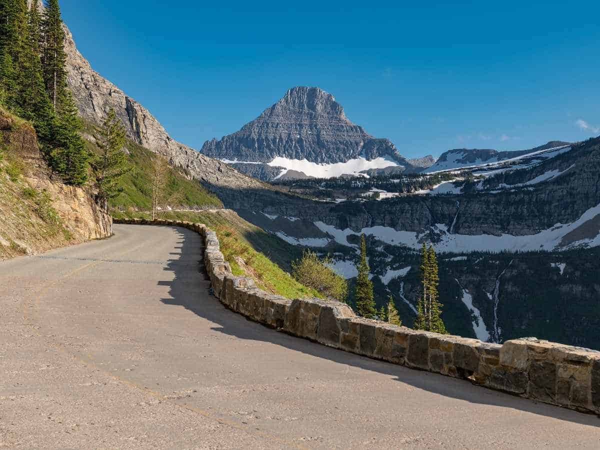
Top 10 Best Hikes in Glacier National Park
I narrowed this list down to a mix of Glacier’s most iconic hikes and a few that fly under the radar, including the trails I hiked, loved, and would recommend to anyone visiting the park for the first time and looking for the best hikes in Glacier National Park.
1. Highline Trail
Distance: 14.9 miles
Elevation Change: 2,621 ft
Rating: Hard
Time Needed: 6-8 hours
Location: East Glacier
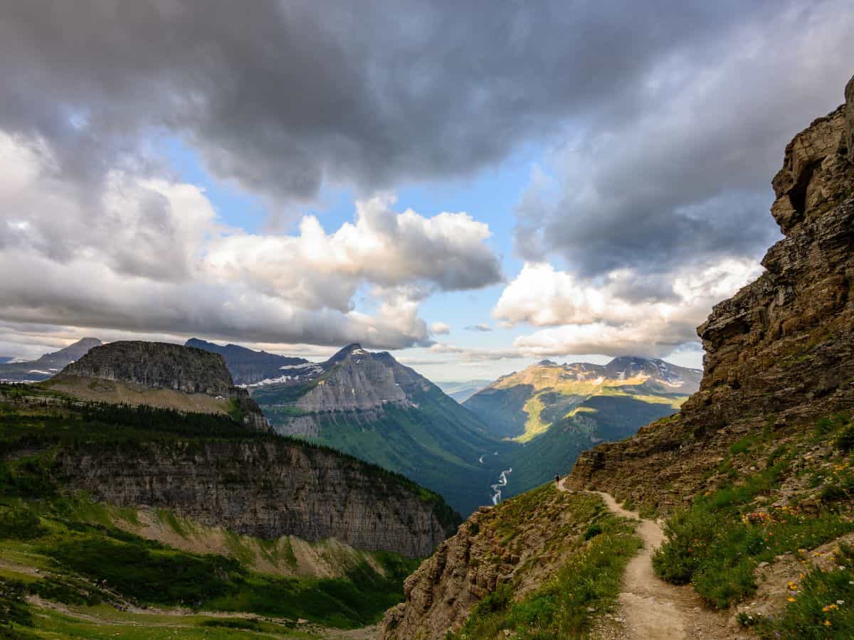
This is Glacier’s crown jewel. The panoramic views and narrow ledge is iconic (and not as scary as it looks!).
I didn’t have time to complete the full trail, but I hiked part of it from the Logan Pass trailhead and it immediately felt epic. When I started this hike around mid-morning (after hiking to Hidden Lake) the trail was already buzzing with hikers.
Even if you don’t have time or interest in the entire trail, I highly recommend hiking the first mile or so of Highline from Logan Pass.
Highline Trail can be completed as an out-and-back, or a point-to-point trail (using the shuttle to return to the trailhead).
If you start at Logan Pass you’ll cross the street and hike the cable section first. The trail is mostly flat for the first 3 miles.
As an out-and-back, Highline is 7.4 miles from Logan Pass to Granite Park Chalet. There’s an optional 0.8 extension on Garden Wall Trail which takes you to Grinnell Glacier Overlook. If you have time I highly recommend hiking to the overlook – you can see multiple lakes and the glacier from above.
An alternative option to hike Highline Trail is the 12.1 mile point-to-point trail, which starts at Logan Pass and ends at The Loop (along Going To The Sun Road). It’s mostly downhill if you start from Logan Pass.
The shuttle operates between both stops so you can catch a ride back (but you will need advanced Glacier shuttle tickets.)
2. Grinnell Glacier Trail
Distance: 10 miles
Elevation Change: 2,047 ft
Rating: Hard
Time Needed: 6-8 hours
Location: Many Glacier
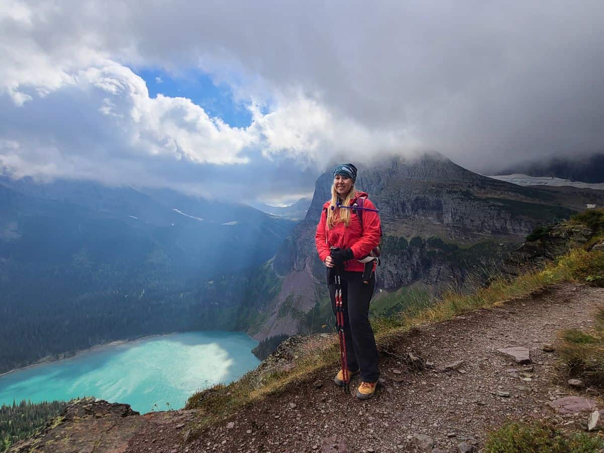
The turquoise glacier melt, mountain peaks, and potential for mountain goat sightings make this one of the best payoffs for your effort. Grinnell Glacier is my favorite hike in Glacier National Park! You can check out my detailed trail overview here.
The trail begins gradually through the forest and along Swiftcurrent Lake, then climbs steadily with epic views of the valley.
There’s limited shade, so start early and bring plenty of water. The last push to the glacier viewpoint is steep, but worth it. I found myself stopping constantly to take photos—it’s that kind of trail.
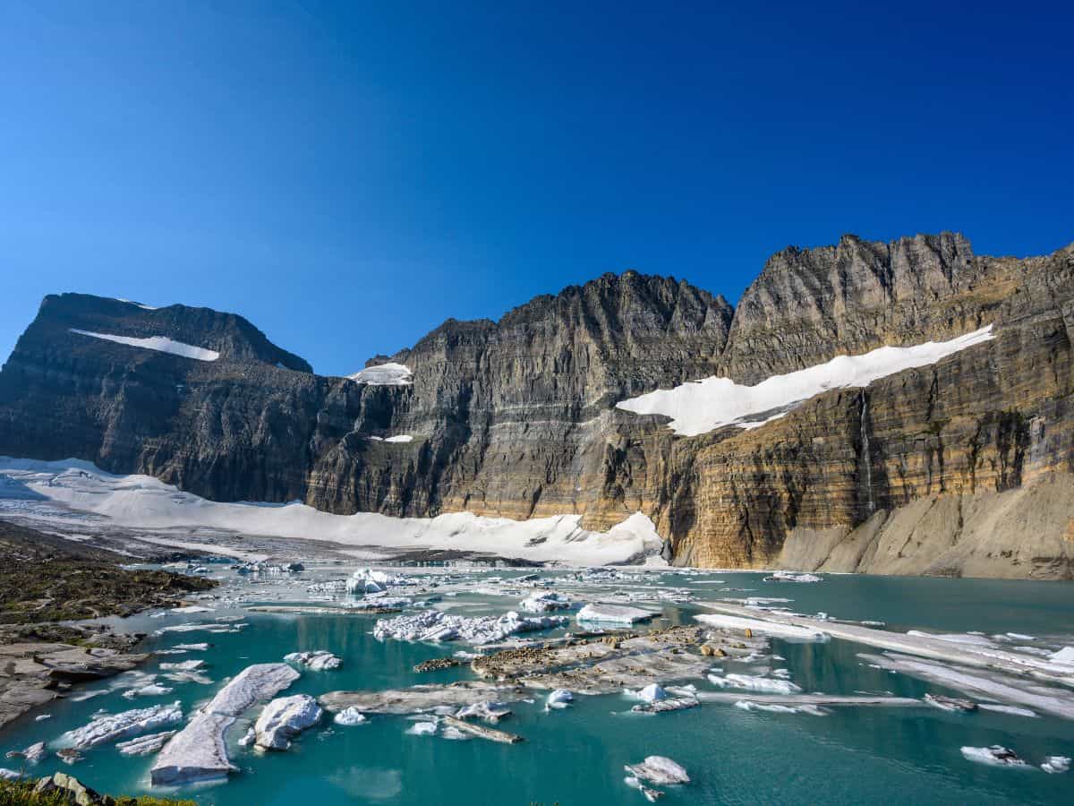
This trail feels like the full Glacier experience: stunning lakes, open views, and wildflowers galore. You’ll pass Lake Josephine and Grinnell Lake far below before finally reaching the edge of Grinnell Glacier.
There’s often snow at the top well into summer, so check trail conditions and be prepared for chilly wind near the glacier.
NOTE: There is an optional boat shuttle which saves you some mileage, but not any elevation, because the first 2 miles of this hike are fairly flat.
National Parks Water Bottle
A fun way to collect all 63 National Parks!
National Parks Passport
Keep track of the parks you’ve visited (with dates!)
America The Beautiful Park Pass
Frequent visitors save money on entrance fees
3. Avalanche Lake
Distance: 5.9 miles
Elevation Change: 757 ft
Rating: Moderate
Time Needed: 2-3 hours
Location: West Glacier
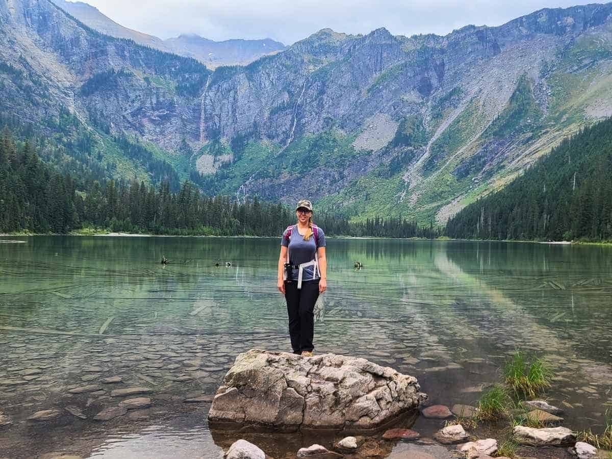
Avalanche Lake trail is a classic for good reason. This is one of the most accessible hikes in the park, and the payoff is huge. I wrote a full guide to hiking Avalanche Lake with even more tips and photos if you’re planning to go.
The hike starts on the Trail of the Cedars, a flat and accessible boardwalk that turns into a well-traveled forest path. It’s a gentle incline almost the entire way. I recommend arriving early—it gets busy by 8 am (or earlier) and there’s limited parking.
The trail is mostly shaded and well-maintained, which makes it perfect for hot days. Once you reach the lake, you can follow the shoreline trail to quieter spots with amazing views of waterfalls cascading down Bearhat Mountain.
TIP: Most hikers stop once they reach the lake, but there’s a narrow trail that continues to the far side of the lake which is much quieter. This is a great spot to jump in the lake if you’re up for a very cold dip.
4. Hidden Lake Overlook
Distance: 2.7 miles
Elevation Change: 551 ft
Rating: Moderate
Time Needed: 1-2 hours
Location: East Glacier

Hidden Lake Overlook trail starts at Logan Pass. There’s a boardwalk with a mild but steady incline to the overlook, and you can frequently spot mountain goats in this area.
The trail is short but exposed, with sweeping views almost immediately.
TIP: This trail has slushy snow and ice well into July. The steady incline makes hiking on the snow very difficult so you’ll want microspikes (something with actual spikes, these are the ones I have).

By mid-summer the meadows are full of wildflowers. If you arrive early in the morning you’re likely to see wildlife, too! A ranger told me someone even saw a wolverine chasing a moose here! (They are super rare to see) The overlook area has a few spots to sit and soak it all in before turning back.
If you’re up for a more difficult hike, I recommend hiking down to the lake. Most hikers turn back at the overlook, so the trail down to the lake is much quieter.
I had lunch at the lake, and then explored around a bit and saw tons of bear and moose tracks along the water! Just keep in mind that the hike back up is extremely steep for the first quarter mile (in fact, it’s mostly just steps built into the hillside.)
Hidden Lake Overlook is wildly popular, and for good reason—it’s easy to access, the views kick in early, and there’s a solid chance you’ll see goats or marmots along the way.
TIP: Logan Pass visitor center parking lot is huge, but fills really early in the morning (often by sunrise). I recommend arriving before daybreak, or in the mid-afternoon when there’s fewer people and it’s easier to find a parking spot.
5. Iceberg Lake
Distance: 9.6 miles
Elevation Change: 1,459 ft
Rating: Moderate
Time Needed: 4-6 hours
Location: Many Glacier

The trail to Iceberg Lake starts gently and gains elevation gradually, passing through open meadows with wildflowers and bighorn sheep.
Iceberg Lake is a popular hike in Glacier National Park. If you want solitude at the lake, get an early start or stay late in the day.
The trailhead is located behind Swiftcurrent Motor Inn, and is adjacent to Swiftcurrent Pass Trail (details later on). I recommend you do both on the same day so you don’t have to re-park your car.
The views along the hike open up early and stay consistent the entire way. The lake itself is stunning, surrounded by steep cliffs, and yes, often full of actual floating ice chunks. There’s plenty of space at the shoreline to sit and relax.
Pack a lunch and a quick dry travel towel so you can dip your feet in the (very cold!) water.
6. Ptarmigan Tunnel
Distance: 10.6 miles
Elevation Change: 2,362 ft
Rating: Hard
Time Needed: 5-7 hours
Location: Many Glacier

A tunnel through the mountain? Yes, really. This trail starts with a steady incline through forest and rocky slopes. You’ll pass Ptarmigan Falls along the way and then start climbing more seriously.
The tunnel is carved right through the mountain and opens to a sweeping view of the valley. Bring layers because the trail can be windy and cool.
The final ascent to the tunnel is exposed but well-built, and the views on both sides are wildly different. I’d recommend starting early to avoid strong afternoon sun on the ascent.
NOTE: Ptarmigan Tunnel initially follows the same trail as Iceberg Lake for the first 2.5 miles before branching off. You could combine both of these hikes for a longer day hike in Glacier National Park and check both off your list!
7. Cracker Lake
Distance: 12.5 miles
Elevation Change: 1,617 ft
Rating: Hard
Time Needed: 5-7 hours
Location: Many Glacier

That water color! The trail starts near the Many Glacier Hotel and winds through brushy areas so it’s especially important to be bear aware here.
The first couple of miles can be muddy and are used for horses (so watch out for poo!), but it quickly clears up into stunning alpine meadows.
Cracker Lake itself is tucked under towering cliffs, with unbelievable milky-blue water.
This hike is long but doesn’t feel like a grind because the elevation gain is relatively modest.
This is a less popular trail, and the lake feels remote and peaceful. If you want a quiet, all-day hike in Glacier National park that still delivers serious scenery, this one’s a gem.
8. Swiftcurrent Pass
Distance: 16.3 miles
Elevation Change: 3,664 ft
Rating: Hard
Time Needed: 8-10 hours
Location: Many Glacier
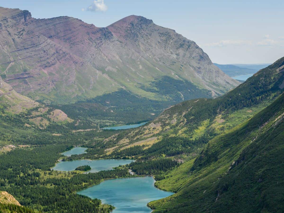
This Glacier National Park hike is a beast, but the waterfalls, alpine lakes, and chance of spotting bighorn sheep and moose are unmatched.
From the start near the Swiftcurrent Motor Inn, you’ll wind past Fishercap Lake and Redrock Falls before climbing steadily toward the pass. The first 4 miles are a relatively mild incline, and then the steep ascent and switchbacks to the summit begin.
The upper section opens up to sweeping views of the surrounding valleys and peaks—some of the best mountain views in the park. But you’ll have to work for it, there are some serious switchbacks towards the end of this hike, gaining around 1,000 feet in elevation in the last mile.
The trail is long and gains serious elevation, so pack plenty of water and snacks.
9. Bullhead Lake
Distance: 6.8 miles
Elevation Change: 439 ft
Rating: Easy
Time Needed: 2-3 hours
Location: Many Glacier
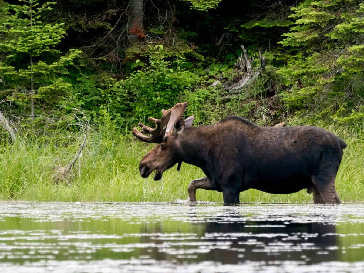
Fewer crowds, plenty of moose, and a peaceful lake at the end? Yes, please. This is one of the best lesser-known hikes in Glacier National Park. A friend recommended this trail as a great place to spot moose during dawn or dusk!
Bullhead Lake trail is actually a shorter section of Swiftcurrent Pass trail (above). The trail to Bullhead Lake passes Fishercap Lake and Redrock Falls early on—both worthy detours for photos or a snack break.
Keep an eye out for wildlife, especially moose, in the meadows and near the water. The lake itself is a calm, peaceful spot with plenty of shoreline to rest, snack, and enjoy the view before heading back the way you came.
10. St. Mary Falls + Virginia Falls
Distance: 3.1 miles
Elevation Change: 452 ft
Rating: Moderate
Time Needed: 1-2 hours
Location: East Glacier
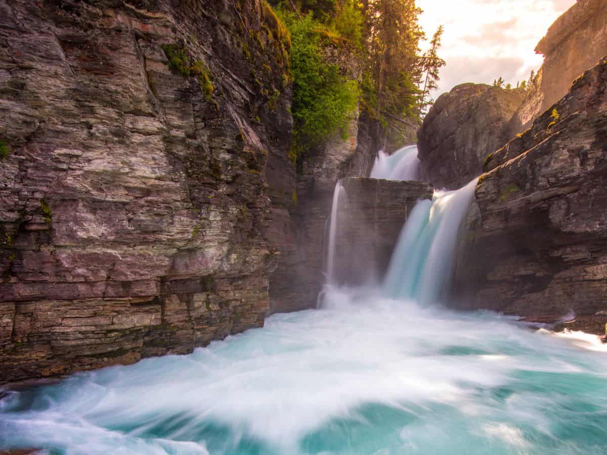
Two waterfalls, one easy hike in Glacier National Park. The trail itself is mostly shaded and runs alongside the river, which makes it especially enjoyable on a hot day.
St. Mary Falls is the first waterfall, followed by Virginia Falls which is bigger, splashier, and has lots of great spots to sit, snack, and hang out.
If you’re into waterfall hikes, I put together a full list of the best waterfalls in Glacier National Park you might want to check out.
I’ve seen people swimming here, and it looks like a perfect spot to cool off on a hot day—just be prepared for freezing water and always be aware of strong currents.
TIP: Parking can be tricky here so aim to arrive early or try your luck in the mid-afternoon once the early crowds have cleared out.
How to Choose the Best Hikes In Glacier National Park
Choosing a hike in Glacier can be overwhelming—there are just so many good ones! Whether you’re looking for something short and mellow or a full-day leg burner, narrowing it down by difficulty or region is a great way to start planning your itinerary.
Glacier National Park Hikes By Difficulty
- Easy to Moderate: Avalanche Lake, Hidden Lake Overlook, St. Mary Falls
- Moderate to Hard: Iceberg Lake, Ptarmigan Tunnel, Cracker Lake
- Hard: Highline Trail, Grinnell Glacier, Swiftcurrent Pass
Glacier National Park Hikes By Region
- West Glacier: Avalanche Lake
- East Glacier: Highline Trail, Hidden Lake, St. Mary & Virginia Falls
- Many Glacier: Grinnell Glacier, Iceberg Lake, Ptarmigan Tunnel, Swiftcurrent Pass, Bullhead Lake, Cracker Lake
Where to Stay in Glacier National Park
Choosing where to stay in Glacier National Park can totally shape your hiking experience, especially if you’re aiming to hit the best hikes in Glacier National Park early in the day (which you should). The closer you are to the trailhead, the better!
Lodges & Hotels: Many Glacier Hotel and Swiftcurrent Motor Inn are right in the middle of the action. They’re pricey and book out months ahead, but worth it for the location. On the west side, Lake McDonald Lodge puts you near Avalanche Lake and the reservation-only shuttle line.
Camping: Glacier has several frontcountry campgrounds, but they book fast. Check Recreation.gov and set an alarm for when sites are released because they go fast!
If you’re planning to camp during your trip, don’t miss my Glacier National Park camping guide.
Nearby Towns: If you can’t get in-park lodging reservations try West Glacier or St. Mary. They’re the closest towns to the park entrances and have small hotels, Airbnbs, and some basic services.
In West Glacier I recommend: West Glacier Cabin Village or Belton Chalet
In St Mary I recommend: St Mary Village or this cozy vacation rental
If you’re planning your full trip and flying into Bozeman, I’ve mapped out the best stops along the way in this Bozeman to Glacier National Park road trip guide.

Essential Logistics for Glacier National Park Hiking
Glacier is one of the busiest national parks in the summer, and planning ahead makes a huge difference. From figuring out the best time to go to dodging the vehicle reservation scramble, here’s what to know before hitting the trail.
2026 Glacier National Park Updates
🎟️ There are no timed-entry reservations required in 2026
🅿️ Parking at Logan Pass is limited to 3 hours
🚌 Going-To-The-Sun Rd has ticketed shuttle services (details here)
What to Pack, Trail Services & Safety Considerations
Here’s what I carried on every hike: bear spray (not optional), 2–3 liters of water, snacks, layers for changing weather (including gloves and a hat! even in the summer it remains cold at higher elevation), sunscreen, and an offline map from AllTrails. Hiking poles came in handy on longer or steeper trails like Grinnell Glacier.
NOTE: You cannot fly with bear spray. Most vacation rentals and local businesses have bear spray you can rent.
Trailheads usually have pit toilets but no water, so fill up before leaving your hotel. You won’t find food in the park outside of a few small lodges (which are inconvenient to most hikes in Glacier National Park), so I packed lunch and extra snacks every day.
Cell service is limited to non-existent. I let someone know my hiking plans each day just in case. Additionally, I recommend sticking to well-trafficked trails for added safety traveling solo.
❤️ My Favorite Hiking App: AllTrails+ ❤️
I’ve used AllTrails for years and love it! They make it easy to find, save, and organize your hikes. You can try it for free here.
Save 30% on AllTrails+ with code EVERYWHERE30
✓ Location Sharing
✓ Offline Maps
✓ Off-Trail Alerts
$2.99/month
When to Visit Glacier for the Best Hiking Conditions
Late June through early September is ideal. July brings wildflowers, while August tends to be drier. Snow can linger into July on high-elevation trails.
During my visit in early September lower elevation (like Apgar Village) had warm temperatures, but higher elevations (like Logan Pass) were already getting early winter snow and temperature below freezing.
If you’re new to hiking, check out my hiking gear for beginners guide to prepare for your trip!

NOTE: Unfortunately, none of these trails are dog friendly but there are several great options for hikes near Glacier National Park for dogs.
Map of the Best Glacier National Park Hikes
This map will help you visualize where the best hikes in Glacier National Park are located so you can plan your itinerary efficiently by region.
How To Use This Map:
1. To open in a new tab, click [] in the top right corner of the map.
2. To save to your Google Maps account, click ☆ (you must be signed in to Google).
3. To use during your trip, open Google Maps on your phone, select “You” from the bottom bar, scroll down and click the maps icon for a list of your saved custom maps.
If you’re looking for help planning your full trip, I’ve got you covered with The Ultimate Glacier National Park Itinerary.