22 Best Glacier National Park Waterfalls To Drive Or Hike To
If you’re looking for the best Glacier National Park waterfalls, you’re in for a treat. There are over 200 waterfalls in Glacier National Park. The park’s dramatic peaks, snowmelt-fed streams, and deep glacial valleys make it the perfect place to see waterfalls, especially in mid-summer when snow melt is at it’s peak.
My recent visit to Glacier National Park was in early September, and even after peak snow melt the waterfalls were still stunning.
In this article:
- 22 best waterfalls in Glacier National Park + map
- Waterfalls you can see from your car
- Short & Moderate Hikes To Glacier National Park waterfalls
- Tips for parking & avoiding crowds
Disclaimer: This article features some affiliate links. I only endorse things I’ve personally used or that come highly recommended by trusted peers. If you purchase anything I mention using my referral links from Amazon, REI or other retailers I may receive a small commission. However, there is never extra cost to you. You can read more here. Thank you for your support.
Glacier National Park Overview
✈️ How To Get There: Fly into Glacier Park (30 min), Missoula (2.5 hr), or Bozeman (5.5 hr)
⛰️ Glacier Must-See: Going-To-The-Sun Road, Avalanche Lake, & Highline Trail
💵 Entrance Fee: $35 or free with an America The Beautiful Pass
🛌 Where To Stay: Lake McDonald Lodge (West side) or Many Glacier Hotel (East side)
TIP: I recommend booking your rental car with Discover Cars. As one of the largest rental car companies, they negotiate the best rates to save you money. They also let you cancel for free up to 48 hours before your pickup, so you can grab a good rate now without stressing if your plans change.
Map of Glacier National Park Waterfalls
To help you plan, here’s a general overview of where each waterfall in Glacier National Park is located. Waterfalls can be found across all major regions: Many Glacier, Two Medicine, St. Mary, Logan Pass, and along Going-to-the-Sun Road.
How To Use This Map:
1. To open in a new tab, click [] in the top right corner of the map.
2. To save to your Google Maps account, click ☆ (you must be signed in to Google).
3. To use during your trip, open Google Maps on your phone, select “You” from the bottom bar, scroll down and click the maps icon for a list of your saved custom maps.
TIP: Download this self-guided audio tour for your trip! It uses GPS signal (no cell connection needed!) to automatically play information about the park based on your location! It’s like having a tour guide with you, but on your own schedule.
Glacier National Park Waterfalls You Can See from the Road
Not all waterfalls in Glacier National Park require a hike. Some of the park’s most beautiful waterfalls are visible from your car!
If you’re short on time or just driving through on the scenic Going To The Sun Road, these are some of the best waterfalls in Glacier National Park to catch quickly.
1. Bird Woman Falls
Waterfall Size: 492 feet
Location: West Glacier
Hiking Distance: none
Rating: None

Bird Woman Falls is one of the tallest waterfalls in Glacier, with water tumbling almost 500 feet from the cliff. It’s most powerful in early summer and can be seen clearly from a roadside pullout west of Logan Pass along Going To The Sun Road.
The overlook can get crowded, especially during the peak summer season, so try to visit early in the day or later in the afternoon for the best experience.
The falls are nestled between Mount Oberlin and Mount Cannon and are fed by melting snowfields and glaciers. As the summer progresses, the flow of the waterfall diminishes.
TIP: Bring a zoom lens or binoculars for a better look.
NOTE: There are no trails that lead to Bird Woman Falls. It’s only visible from the road.
2. Weeping Wall Falls
Waterfall Size: Unknown
Location: West Glacier
Hiking Distance: none
Rating: none

Like Bird Woman Falls, Weeping Wall is also only viewable from Going-to-the-Sun Road, just west of Logan Pass.
It’s not a traditional waterfall, but rather a series of cascades where water flows directly over the retaining wall of the road, creating a “weeping” effect.
The wall is especially dramatic after a rainy day or during peak snowmelt. West-bound traffic drives right under the waterfall, however there are no pull-offs here so you cannot stop and get out of your car.
As the summer progresses and the snowmelt decreases, the flow of water lessens, and the wall may only have a slight “weep” to it. During my visit in September the water was barely present here.
TIP: You can see Weeping Wall Falls from the parking area along the bend at Paradise Meadow Overlook. However, Going-To-The-Sun Road is very narrow along this section so you cannot walk up to the waterfall.
3. McDonald Falls
Waterfall Size: Unknown
Location: West Glacier
Hiking Distance: none
Rating: none

McDonald Falls are located approximately 2 miles east of Lake McDonald Lodge, just a short walk from the parking area. There’s a designated viewing platform where you can see the river-fed waterfall and get some great photos without straying far from your car.
Interestingly, the best spot to view McDonald Falls might not be from the official viewing area, but rather from the road before descending the stairs, depending on how thick the obstructing vegetation is at the time of your visit.
4. Sacred Dancing Cascade
Waterfall Size: Unknown
Location: West Glacier
Hiking Distance: 0.2 miles
Rating: Easy

Just upstream from McDonald Falls, Sacred Dancing Cascade flows over mossy rock and can be viewed from a scenic bridge. Interpretive signs explain the origin of the name, which honors the cultural significance of the area to Native American tribes.
This Glacier National Park waterfall is easily accessible with a short 0.2-mile walk from the roadside parking area.
TIP: If you’re also visiting Avalanche Lake Trail or Trail of the Cedars this is a great post-hike stop in the same area of the park.
5. Lunch Creek Falls
Waterfall Size: Unknown
Location: East Glacier
Hiking Distance: none
Rating: none

Lunch Creek Falls is a tiered waterfall in Glacier National Park close to Logan Pass and is often overlooked. However, it’s a perfect place for a picnic lunch (ergo the name), especially after hiking Hidden Lake Overlook or Highline Trail.
Keep an eye out for marmots here – they’re frequently found hanging out in the surrounding rocks.
This area of the park, near Logan Pass, sits at higher elevation and can be quite cold even well into the summer months. Be sure to pack your winter hiking essentials.
TIP: There are pull offs located along Going-To-The-Sun Road just under 1 mile East of Logan Pass Visitors Center.
6. Silver Staircase Falls
Waterfall Size: 40 feet
Location: Two Medicine
Hiking Distance: none
Rating: none

Silver Staircase Falls is a stunning 40-foot waterfall located just outside of Glacier National Park, along Highway 2 (the primary road following the southern border of the park.)
The falls are easily accessible from the road and cascade down the cliffs in a series of steps, creating a “staircase” effect.
TIP: The turnout here is small and easy to miss, so drive slowly to spot it.
Short Hikes To Waterfalls In Glacier National Park (Under 3 Miles)
These trails are perfect if you’re short on time or not looking to tackle anything too strenuous. Many of them lead to some of the best waterfalls in Glacier National Park, all within a quick round-trip walk.
7. Running Eagle Falls (aka “Trick Falls”)
Waterfall Size: 40 feet
Location: Two Medicine
Hiking Distance: 0.7 miles
Rating: Easy

Running Eagle Falls, also known as “Trick Falls,” is located in Two Medicine. There’s a short 0.7-mile loop which leads to the dual-flow waterfall in Glacier National Park.
In spring, water bursts from the cliff above and appears as one waterfall as it obscures the second waterfall below it. By late summer, the water volume decreases and a hidden cave appears behind the falls. It’s one of the most unique Glacier National Park waterfalls.
The trail is a wide, well-maintained path and is one of two handicap accessible trails in Glacier National Park (Trail of the Cedars is the other).
NOTE: The waterfall is named after Pitamakan, or Running Eagle, a female warrior leader of the Blackfeet Nation in the early 1700s.
8. Appistoki Falls
Waterfall Size: Unknown
Location: Two Medicine
Hiking Distance: 1.3 miles
Rating: Easy

Appistoki Falls is less visited than other waterfalls in Glacier National Park, so it’s a great way to avoid crowds. Since it’s located in Two Medicine, it’s also a great option if you can’t get reservations for Going To The Sun Road.
The hike to Appistoki Falls is 1.3 miles, and during the summer there are lots of wildflowers along the trail. This is also a segment of the Continental Divide Trail, which stretches from Mexico to Canada.
NOTE: The name “Appistoki” comes from the Blackfeet language, and refers to the Native American god who looks over everyone and everything.
9. Trail of the Cedars
Waterfall Size: Unknown
Location: West Glacier
Hiking Distance: 0.9 miles
Rating: Easy

Trail of the Cedars is a 0.9 mile loop trail through old-growth forest, surrounded by massive cedar and hemlock trees. It’s also one of two wheelchair-accessible hikes in Glacier National Park, and follows a boardwalk that winds through the forest.
One of the highlights of this trail is the footbridge that crosses Avalanche Creek with a stunning view of the lower Avalanche Gorge and a cascading waterfall.
This trail is also the gateway to Avalanche Lake trail, so you have the option to combine it with another one of the best waterfalls in Glacier National Park! (more on Avalanche Lake waterfalls later)
I hiked to Avalanche Lake first, and by the time I returned to complete Trail of the Cedars around mid-morning this spot was already very busy and crowded.
TIP: This waterfall shares a very small parking area with Avalanche Lake. Come early (before 8 am) or after mid-afternoon to find parking more easily.
10. Baring Falls
Waterfall Size: 25 feet
Location: East Glacier
Hiking Distance: 1.3 miles
Rating: Easy

The next 3 falls are the best waterfalls in Glacier National Park – and they’re all along the same trail so it’s possible to see all of them with a short hike.
Baring Falls is a popular 1.3 mile hike near Sunrift Gorge. It starts at Sun Point and follows the Piegan Pass Trail. The waterfall drops about 25 feet over a rock ledge and flows into Saint Mary Lake.
You can also continue along Piegan Pass Trail to St Mary Lake Trail to two more waterfalls in Glacier National Park; St Mary Falls and Virginia Falls. From Sun Point to Virginia falls and back is around 6 miles.
TIP: If you also plan to see St. Mary & Virginia Falls I recommend parking at Sun Point and hiking to all three waterfalls from there. It has a much larger parking lot than the St Mary trailhead (which only has 19 parking spots).
11. St. Mary Falls
Waterfall Size: 35 feet
Location: East Glacier
Hiking Distance: 1.7 miles
Rating: Easy

St. Mary Falls is one of the park’s most iconic hikes in Glacier. The 1.7-mile trail is mostly flat and rewards you with a powerful 35-foot waterfall plunging into bright teal water.
There is a bridge directly in front of the falls with great views, and during the early summer when the falls are powerful you can also feel the spray from the bridge.
This hike follows the same trail as Virginia Falls, which is another 0.7 miles (one-way) up the trail.
12. Virginia Falls
Waterfall Size: 50 feet
Location: East Glacier
Hiking Distance: 3.1 miles
Rating: Moderate

Just beyond St. Mary Falls, this two-tiered Glacier National Park waterfall is surrounded by wildflowers in summer. The hike to Virginia Falls is 3.1 miles in total, and passes St Mary Falls.
Sadly, the area was affected by the Reynolds Creek Fire of 2015, so you’ll pass through a burned section before arriving at the 50-foot falls.
TIP: There are pit toilets near Virginia Falls. They’re just over the bridge at the lower falls. I recommend bringing your own toilet paper, especially during the busy season.
Virginia Falls is one of the best waterfalls in Glacier National Park you can hike to. Before reaching the waterfall, you’ll pass two series of cascades and waterfalls that are also worth a stop. For whatever reason, these are still unnamed.
TIPS FOR PARKING: It can be almost impossible to find parking at the limited St Mary trailhead parking lot. Your best chance of getting parking here is arriving around dawn, or after 3 pm.
There are also several other parking areas nearby (that will add a little distance to your hike); Sun Point has the largest parking area, or there are multiple small pull-offs along Going To The Sun Road and additional parking at the Siyeh Pass trailhead.
Even in early September, after the busy season, I could not find parking at the St Mary trailhead and had to park at Sun Point instead.

13. Apikuni Falls
Waterfall Size: 100+ feet
Location: Many Glacier
Hiking Distance: 1.8 miles
Rating: Moderate

The hike to Apikuni Falls is 1.8-mile round trip with some steep sections. It ends at the falls with a dramatic 100-foot drop and panoramic views of the Many Glacier area. I think the views in Many Glacier are the prettiest in all of Glacier National Park.
While this is a shorter hike in Glacier National Park, it’s uphill the entire way with quite a bit of elevation gain – more than 600 feet in under a mile.
You can get close enough to this waterfall in Glacier National Park to touch it – but you’ll need to scramble some boulders in order to reach it.
NOTE: The name “Apikuni” comes from the Indian name given to James Willard Schultz, a noted author, explorer, guide, and historian of the Blackfoot Indians.
TIP: Parking at the trailhead is extremely limited (about 12 parking spaces) so arriving before 8 am or after 3 pm is the best way to get a spot. You can also park at Many Glacier Hotel, which has a much larger lot, but ads about 1.5 miles (one-way) to your hike.
14. Twin Falls
Waterfall Size: Unknown
Location: Two Medicine
Hiking Distance: 2 miles
Rating: Easy

Twin Falls is reachable via boat shuttle across Two Medicine Lake and then a 2-mile trail. The shuttle only runs from June through September, and advanced reservations are required due to extremely limited space.
Alternatively, you can hike the entire distance to this Glacier National Park waterfall… around 7 miles if you take the out-and-back trail along the north shoreline of Two Medicine Lake, or 8 miles if you loop the lake.
15. Deadwood Falls
Waterfall Size: 10 feet
Location: East Glacier
Hiking Distance: 2.2 miles
Rating: Moderate

Deadwood Falls is found along the Piegan Pass trail, and is 2.2 miles roundtrip from Jackson Glacier Overlook, along Going To The Sun Road.
You can also hike to Deadwood Falls from the opposite direction, starting at St Mary Falls trailhead but you’ll add a little more than a mile to your total distance.
The trail is downhill from Jackson Glacier Overlook, so be prepared for a 600 foot climb on your way back.
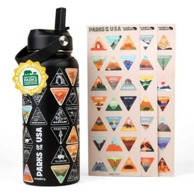
National Parks Water Bottle
A fun way to collect all 63 National Parks!
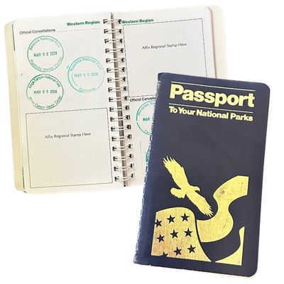
National Parks Passport
Keep track of the parks you’ve visited (with dates!)
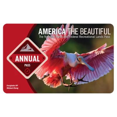
America The Beautiful Park Pass
Frequent visitors save money on entrance fees
Hikes to the Best Waterfalls in Glacier National Park
While there are plenty of falls that don’t require a longer hike, they’re often more crowded with tricky parking.
I think the best waterfalls in Glacier National Park are the ones that take a bit more effort to get to! If your Glacier National Park itinerary allows, hiking to these waterfalls is a great way to avoid the crowds and experience more of Glacier during your visit.
16. Redrock Falls
Waterfall Size: Unknown
Location: Many Glacier
Hiking Distance: 3.7 miles
Rating: Easy

Redrock Falls is one of the best waterfall hikes in Many Glacier – it’s 3.7 miles and passes Fishercap Lake (a great place to see Moose) and alpine meadows before ending at the falls.
The trail is relatively flat so it’s perfect for beginner hikers, and the pool below the falls is a great place to dip your toes in, or go for a swim if you’re brave enough to get in the chilly water.
In order to get to Redrock Falls you’ll follow the Swiftcurrent Pass trail, which starts behind Swiftcurrent Motor Inn. This is also the trailhead for several of the best hikes in Glacier National Park.
From Redrock Falls you can extend your hike to Bullhead Lake which adds another 3 miles.
TIP: this area has tons of thimbleberries and huckleberries. Bears love these, so keep your eyes peeled and carry bear spray where you can easily reach it.
17. Ptarmigan Falls
Waterfall Size: 30+ feet
Location: Many Glacier
Hiking Distance: 5.2 miles
Rating: Moderate

Ptarmigan Falls is located on the Iceberg Lake Trail. If you’re just going to the falls the trail is 5.2 miles roundtrip. However, if you want to see Iceberg Lake the trail is 9.6 miles total.
The hike starts through open terrain with great views of Many Glacier, and then enters a dense section of pine forest – keep an eye out for bears! When you reach Ptarmigan Falls there’s a wooden bridge crossing Ptarmigan Creek with great views of the falls below.
Even though this area of Glacier National Park is known for a lot of bear activity, I still chose to hike alone (one of the side effects of traveling solo).
If you aren’t able to hike in a group, my best solo female travel safety tips for outdoorsy girls like me is to time your hike so you’re sharing the trail with others.
I usually try to hit the trail right after a large group, and stay within earshot of them – that way there’s someone else ahead of me on the trail to intercept trouble, and also someone who will hear me shout if I need help.
TIP: The trailhead for Ptarmigan Falls is right next to the trailhead for Swiftcurrent Pass trail. I recommend combining your hikes in this area so you don’t have to shuffle around parking lots – this can eat up a lot of time, especially during the summer when parking lots are at capacity. Many Glacier Campground is also located near these trailheads, so it’s the best campground in Glacier National Park if you want easy access to epic hikes.
18. Grinnell Falls
Waterfall Size: 960 feet
Location: Many Glacier
Hiking Distance: 10 miles
Rating: Hard

Grinnell Falls is not only one of the best waterfalls in Glacier National Park, it’s also my favorite hike. You can read more details about the hike to Grinnell Glacier here.
The trail is 10 miles, but not overly difficult. As you approach the glacier, views of Grinnell Falls appear above Grinnell Lake. I think this is the prettiest view in Glacier.
The first portion of the trail is fairly flat and follows several lakeshores. It’s not uncommon for heightened bear activity in this area so be cautious!
As you leave the lakes the elevation starts to climb up to the glacier – it’s really common to see bighorn sheep in this area. I spotted several on my hike. They blend into the rocks really well so keep your eyes peeled.
TIP: It can get very windy towards the glacier so pack layers! Even in early September I was glad to have spare gloves and a hat in my backpack.
19. Avalanche Lake Falls
Waterfall Size: Unknown
Location: West Glacier
Hiking Distance: 5.9 miles
Rating: Moderate

Avalanche Lake Falls is one of the most popular Glacier National Park waterfalls. The trail is 5.9-miles through mostly-shaded forest. Chances are you won’t be alone, but the trail is wide and well maintained so it’s a fairly easy hike.
The trailhead for Avalanche Lake starts at Trail of the Cedars and follows Avalanche Creek. Once you reach the lake you’ll see the waterfalls on the opposite shore.
While I did not find most of this trail is difficult, there is a modest elevation gain of 730 feet that’s consistent throughout the hike.
There’s a narrow path that follows the shoreline to the opposite side of the lake. If you have time I recommend checking it out! This side of the lake was much less crowded when I visited.
It’s possible to swim in Avalanche Lake, but it’s very cold. I packed my swimsuit and was considering getting in… until I saw a group of boys jump in and then get out immediately because of how chilly the water is.
20. Rockwell Falls
Waterfall Size: 40 feet
Location: Two Medicine
Hiking Distance: 6.6 miles
Rating: Moderate

From Two Medicine’s South Shore Trailhead, this 6.6-mile hike to Rockwell Falls leads past meadows, beaver ponds, and a swinging bridge over Paradise Creek.
It’s a moderate trail with very mild elevation (except the first 0.1 miles that’s pretty steep, but very short).
About 1.1 miles into your hike the trail splits, giving you the option for a short detour to see Aster Falls. This adds about half a mile total.
Rockwell Falls consists of two separate waterfalls, with the main visible falls dropping roughly 40 feet.
TIP: This trail is known to be buggy so bring bug spray! Moose are also frequently seen on this hike.
21. Florence Falls
Waterfall Size: 100+ feet
Location: East Glacier
Hiking Distance: 10 miles
Rating: Moderate

Florence Falls is one of the lesser-known waterfalls in Glacier National Park, but it’s also one of the most impressive. The trail to the falls is 10 miles roundtrip and passes Deadwood Falls on the way.
Once you get past Deadwood Falls, the trail becomes a lot less busy. It can be overgrown in areas (especially the last mile) so I recommend wearing pants for this hike.
You will also pass through thimbleberry patches, which is a favorite food for grizzly bears in spring so remember to pack your bear spray.
When you reach the base of Florence Falls, you might need to scramble up the hillside a bit to get a full view of the waterfall.
22. Beaver Chief Falls
Waterfall Size: 1,291 feet
Location: West Glacier
Hiking Distance: 16.4 miles
Rating: Strenuous

Beaver Chief is one of the tallest waterfalls in Glacier National Park with a drop over 1,200 feet. It’s also one of the hardest waterfalls to get to, requiring a strenuous 16.4-mile backcountry hike from Lake McDonald to the base of Lincoln Lake.
This hike is challenging not only because of it’s length, but also because it requires some route-finding, so I only recommend tackling this trail if you’re an experienced hiker.
The falls are located between Lincoln Lake and Lake Ellen Wilson and descend in a series of braided drops, with the tallest single drop measuring at 517 feet.
Due to its remote location and the strenuous nature of the hike, Beaver Chief Falls remains one of the more secluded and pristine waterfalls in Glacier National Park. I think this makes these falls even more special!
NOTE: If you’d prefer to make this a multi-day hike you can spend the evening at Lincoln Lake Backcountry campsite, just remember to make advance reservations.
When to See the Best Waterfalls in Glacier National Park
The best time for chasing Glacier National Park waterfalls is from late June to early August. That’s when snowmelt is at its peak, and the falls are most dramatic.
In early June, some trails may still have snow and certain areas may be inaccessible (especially trails located along Going To The Sun Road, which doesn’t typically open until mid June).
July is ideal for both accessibility and volume, while August tends to be a bit drier. The downside to visiting Glacier National Park in July are the crowds and vehicle restrictions, but in my opinion it’s still worth it to see these waterfalls in Glacier National Park during their peak.
By September, waterfalls begin to taper off and dry out. But in my experience, early September is still a great time to see some of the bigger waterfalls in Glacier, and you won’t have as hard of a time finding parking at more popular trailheads.
Regardless of when you visit, my best piece of advice is to go early. The closer to sunrise you can arrive, the easier it will be to find parking and enjoy a (somewhat) peaceful trail.

Tips For Seeing Waterfalls In Glacier National Park
These tips helped me avoid the crowds and enjoy the hiking trails on my trip!
✨ Get An Early Start – try to get to the trailhead by 8 am, or early. If you’re visiting Glacier in July or August I recommend getting to the trailheads before 7 am – especially for Avalanche Lake or Logan Pass hikes. Alternatively, arriving after 3 pm is ideal as there tends to be more parking available later in the day.
✨ Download Maps BEFORE You Arrive – There is no cell service in Glacier National Park, so you won’t be able to use your maps for directions unless you’ve already downloaded them to your phone ahead of time. I recommend downloading Offline Maps in Google Maps as well as the trails you want to hike in AllTrails.
❤️ My Favorite Hiking App: AllTrails+ ❤️
I’ve used AllTrails for years and love it! They make it easy to find, save, and organize your hikes. You can try it for free here.
Save 30% on AllTrails+ with code EVERYWHERE30
✓ Location Sharing
✓ Offline Maps
✓ Off-Trail Alerts
$2.99/month
✨ ALWAYS Have Bear Spray Within Reach – I don’t say this to scare you. There are bears in Glacier National Park, but it’s unlikely you’ll see any (especially not up close).
However, you must carry bear spray AND know how to use it AND have it somewhere you can reach it in seconds… not buried at the bottom of your backpack.
If you’re flying to Glacier National Park then you cannot bring bear spray with you on the plane and you’ll have to buy or rent it when you arrive. There are many places that rent bear spray (many vacation rentals, hotels near Glacier National Park, and shops in Apgar Village).
✨ Want To Swim At Glacier National Park? – You can, and there are plenty of places to take a dip! Just be prepared for very cold water.
I like this lightweight travel towel for hiking – it doesn’t take up much space, isn’t heavy to carry around, and does a great job at warming me up after a swimming in an alpine lake. In fact, I like it so much I included it on my list of gifts for outdoorsy girls!
READ MORE: My review of the best travel towels for backpacking, camping, hiking and lightweight travel.
Please always, always, always know what’s in the water before you jump in. Also pay attention to the current, especially near the waterfalls in Glacier National Park. Current in rivers can be much stronger than you expect.
Planning A Trip To Glacier?
Check out these additional resources to help you plan your trip to Glacier National Park:
- Itinerary For Glacier National Park: Day-By-Day Guide + Map
- Bozeman to Glacier National Park Road Trip
- 37 Best Stops On Going To The Sun Road
- The Best Hotels Near Glacier National Park
- 21 Best Hikes In Glacier National Park For Every Skill Level
- The Best Hiking Gear For Beginners
Travel Planning Resources
These are the resources I use and recommend for planning your next trip:
Accommodations: Expedia (hotels), VRBO (vacation rentals)
Flights: Skyscanner
Rental Cars: DiscoverCars and Outdoorsy
Tours & Excursions: Viator and GetYourGuide
Travel Insurance: SafetyWing
Credit Card With Travel Points: Chase Sapphire Preferred